
Extensions in Sudbury
Which of Sudbury's five building periods your house belongs to decides the ground, the fire rules and the planning route.
 Fig. 01
Extending in Sudbury
A town rather than a village, which means most of the extension work happens on streets the conservation area never reaches.
Sudbury is twelve or thirteen miles from us, over the county line, and it is the largest place we work in outside Colchester itself. That size is the first thing to understand about building here. Nayland and Bures are single settlements with one set of rules over them. Sudbury has a medieval core, a Georgian commercial centre, streets of nineteenth century weavers’ terraces, several thousand houses put up between 1950 and 1980, and a new estate on the northern edge still being finished. Those are five different jobs.
The town sits on the eastern bank of the Stour where the river loops west, with grazing marshes wrapped round it on two sides. The historic part is squeezed between those marshes and the roads fanning east, which is why the old streets are tight and the newer ones are not.
Babergh District Council, and the plan it is working to
Suffolk, not Essex, and a development plan that is more recent than the one most of our Essex work is judged against.
Applications in Sudbury are determined by Babergh District Council, which runs a shared officer structure with Mid Suffolk District Council from a joint planning service. Sudbury Town Council is a consultee, not the decision maker. Suffolk County Council is the highway authority, so a skip permit, a dropped kerb or anything touching the footway goes there rather than to Babergh.
The adopted development plan is the Babergh and Mid Suffolk Joint Local Plan Part 1, adopted in November 2023 and running to 2037. There is no made neighbourhood plan over the town, which is not the position a few miles up the valley in Long Melford. A Part 2 was dropped after the revised national policy framework of December 2024, in favour of a full review out to the mid 2040s, and a call for sites closed in January 2026. For a householder extension that changes nothing directly. It matters because the design and amenity policies your application is weighed against are three years old rather than fifteen, and officers apply them fairly closely.
On building control you can use Babergh’s own team or a private sector body, which since the Building Safety Act reforms of October 2023 is a registered building control approver working through registered building inspectors. What an approver issues at the end is a final certificate; a completion certificate comes from the local authority.
The housing stock, by period
Five distinct waves of building, and which one your house belongs to decides almost everything else.
The Georgian centre is Suffolk white brick with low pitched slate roofs, made at the brickworks that once stood at Ballingdon. Behind a good many of those white brick fronts is an older timber frame that was refaced to suit eighteenth century taste, sometimes with a brick parapet hiding a steep plain tiled roof. If your roof pitch is steeper than the front of the house suggests, that is usually why.
The three storey terraces are the ones people misjudge. They were built for the nineteenth century silk industry, generally in runs of three or more, one window per floor, with the first floor opening noticeably wider than Georgian proportion would allow because the weaver needed the light. They have no side access, a small rear area, and a shared party wall on each side.
Later Victorian development is red or white brick with slate. Then comes the biggest single wave: Sudbury and Great Cornard took London overspill through the 1950s and 1960s under the County of London plan, and Great Cornard came close to trebling in population in that decade alone. That produced a large stock of council built semis and terraces, most of which have since been bought, which is why a Right to Buy transfer deed and its covenants are worth reading before anything is drawn.
The most recent layer is Chilton Woods on the northern edge, an outline permission granted in March 2018 for 1,150 homes with delivery running since 2021. On a site of that scale the permitted development rights are commonly restricted by a condition on the estate permission rather than by any designation, so the check there is the decision notice, not the conservation map.
The conservation area, and the local list beneath it
Designated in 1973 and redrawn twice since, with a second, softer layer of protection over about three hundred unlisted buildings.

The Sudbury conservation area was designated by the former West Suffolk County Council in 1973, inherited by Babergh in 1974, and its boundary was revised in 1981 and again in 2003. The current line is what counts, and it is not intuitive from the street.
Inside it the land is article 2(3) land under the permitted development order. Class A stops covering side extensions and rear extensions of more than one storey. Class B stops covering enlargement of the roof, which takes a rear dormer out of your hands and into an application. Cladding an elevation needs consent. Class C, which covers other roof alterations, carries no such exclusion, so a rooflight sitting within the plane of the slope remains permitted development on designated land, front slope included, provided it projects no more than 150mm beyond the plane of the original slope, sits no higher than the highest part of the original roof, and is obscure glazed if it faces sideways. That last condition applies everywhere, not only here.
An Article 4 direction can remove any of that on a particular street or a particular house, and a direction is a local instrument that will not show up in the national rules. It costs nothing to have Babergh confirm the position against your address before you rely on a right, and that is the check we make first. How an Article 4 direction actually works is worth ten minutes if you are counting on permitted development.
Sudbury also has something most of the surrounding villages do not. Around three hundred unlisted buildings, catalogued in a survey of the town’s unlisted heritage, sit on a local list. That does not create a consent regime. It does mean the officer treats the building as a heritage asset and weighs harm against benefit, so a proposal that would pass unremarked on a 1960s semi gets read more carefully on a white brick terrace in Cross Street.
Listing is a separate matter again. Where a building is listed, listed building consent applies to it alongside planning, covering the interior as well as the outside, and unauthorised work is a criminal offence. What listing does not do is remove the Part 1 rights covering extensions and roof work. Both regimes run at once, and the second is usually the harder one. Extending a listed building sets out how the two fit together.
Four different grounds inside one town
Sudbury sits where three geologies meet, and a foundation depth taken from a neighbour’s job half a mile away is a guess.
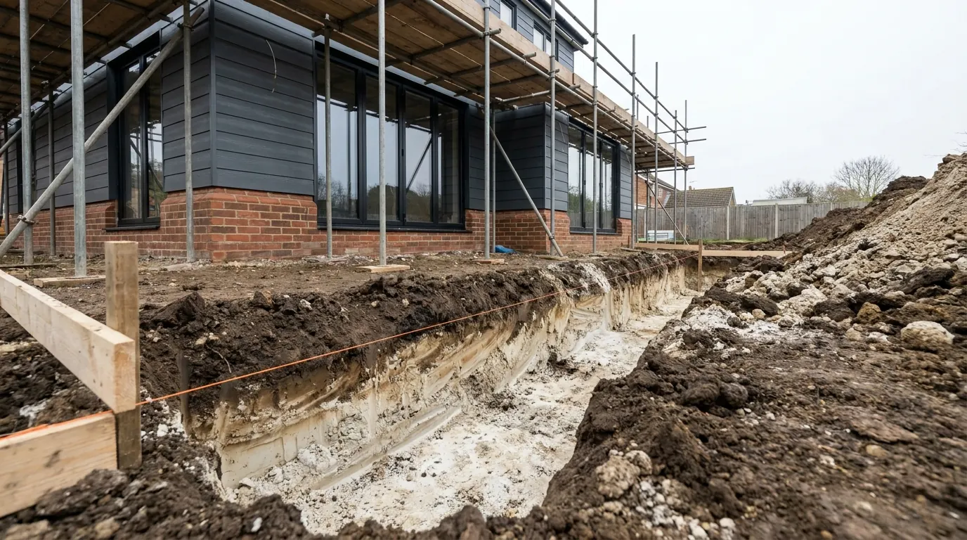
The town centre stands on a platform of terraced valley gravels, roughly 25 to 35 metres above ordnance datum. Ballingdon Street, across the river to the south west, spans the valley on recent alluvium. On the higher ground to the north and east you are into the boulder clay of high Suffolk, the same deposit that runs on under Lavenham, with chalk beneath it to the north of the town. To the south there is an intervening layer of London Clay, which reaches its northern limit here.
That last point matters to anyone who has had work done in Essex. London Clay behaves predictably enough that an engineer can design for it before the trial hole is open. A glacial till does not: it is a mixed deposit of clay, sand, silt, chalk and flint that varies over short distances, and its volume change potential has to be established from a sample rather than assumed. Alluvium in particular can be soft to a depth that changes the foundation type rather than the depth.
So the trial hole is not a formality in Sudbury, and neither is the soil sample. What decides foundation depth covers the mechanism; the local application is that four adjacent streets can give four answers.
The meadows, and what a flood zone actually stops
Roughly 115 acres of the floodplain has been common grazing since about 1260, which is why the flood risk here sits at the edges of the town rather than through it.
The Sudbury Common Lands are water meadows on the Stour floodplain, held under a charter from Richard de Clare of around 1260 giving the town’s freemen grazing rights. Cattle come off in the autumn before the ground saturates. Those meadows are managed by a charity and will not be built on, which means the functional floodplain immediately around Sudbury is largely undeveloped and the flood question for houses arises at the fringes: Ballingdon Street, the streets running down to the Croft, and anything low on the river side.
Worth correcting, because local documents blur it: the Dedham Vale National Landscape, formerly called an AONB, does not reach Sudbury. Its boundary runs up the Stour from Manningtree and stops about a mile short of Bures, and an extension towards Sudbury has been argued for since 2013 without being made. The wider Stour valley partnership area does reach further upstream, but it is a management project rather than a designation.
Where it does arise, the Environment Agency flood map for planning is drawn as though defences are not there, so a property can sit in a higher zone than its actual experience suggests. An extension to an existing house is treated differently from a new dwelling, which is the part people get wrong in both directions: neither automatically refused nor automatically ignored. Finished floor levels, flood resilient construction below a set level and a flood risk assessment can all be conditioned.
Three storeys, and the line at 4.5 metres
The weavers’ terraces are three storeys tall on a narrow plan, and that changes the fire requirement before anything else is decided.
The Approved Document B trigger is the height of the floor above ground level, with 4.5 metres as the line, not the number of storeys. On a three storey terrace the top floor is comfortably above it, so an escape window is not the answer: you need a protected stairway running down to a final exit, with fire doors off it, and that reaches through every floor below. Convert the roof of one of these houses and the same requirement lands on the whole staircase.
The wide first floor opening brings a second problem. It sits over a narrow pier of brickwork, and anything you do at ground floor that changes the load path underneath has to account for what is already spanning above. Escape routes and fire separation is the detail; the short version is that on a tall narrow house it is a cost, not a formality.
Archaeology under the old town
Most of the centre is an area of archaeological interest, and the trigger is the dig rather than the building.
The county record lists close to ninety archaeological features in Sudbury, and the medieval town boundary runs a rough semicircle along Friars Street, Burkitts Lane and Croft Road with the river closing it to the west. Within that, an application can attract a condition requiring a watching brief before the foundations go in. Usually that is a day or two and a report rather than a dig, but it has to be programmed, because the condition is discharged before you break ground rather than after.
Access, materials and what people build
Everything in the old centre comes through the house; everything on the estates comes round the side.
On the terraces there is no side access at all, so muck out and materials in both go through the hallway, and that is a real cost line rather than an inconvenience. Parking is metered or restricted across much of the centre, and a skip on the highway needs a permit from Suffolk County Council. On the post-war and later estates none of that applies: there is a driveway, a side gate and room for a grab lorry.
Matching brick is the other Sudbury-specific cost. Suffolk white is not a stock item in the same way red brick is, and a nineteenth century white brick that has weathered for 150 years cannot be matched off a pallet. On the terraces the honest answers are usually to take the addition round the back where it is not seen with the front, or to be openly modern about it. Getting brickwork to match explains what actually controls the outcome.
What gets built follows from all of it. On the estates: single storey rear extensions to open up a kitchen, and loft conversions where the roof is cut rather than trussed. Garage conversions are constant on that stock too. In the older streets: rear additions, often narrow and deep, and internal openings where the plan is too cellular for how people live now. Very little side extension work happens in the centre, because there is nowhere to put it.
Getting a price for a Sudbury extension
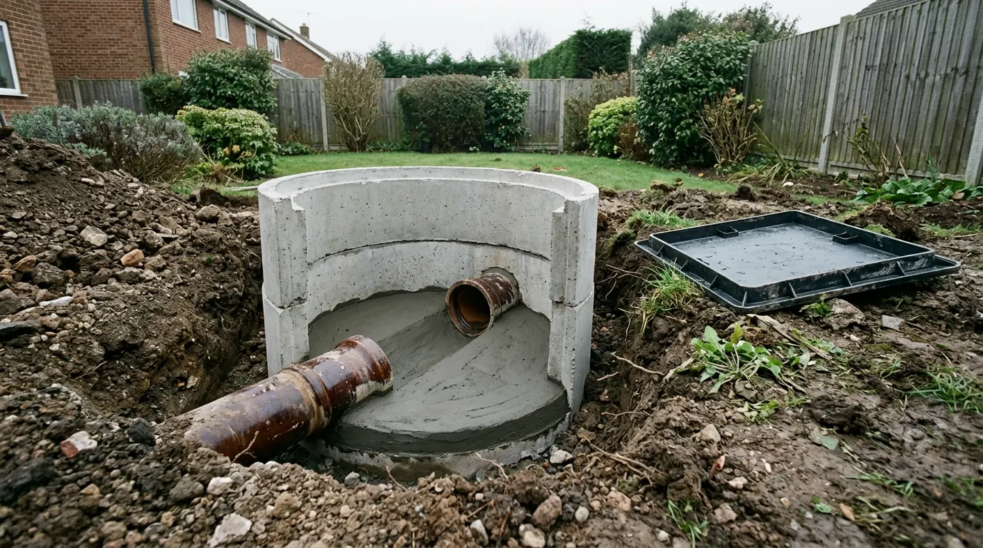
Our team surveys the property himself before anything is quoted: the ground, access, the existing footings where they can be seen, the drain runs and their manhole covers, the conservation and local list position on your specific address, and whether the house is one of the ones with a frame behind the front.
Most people who call us already have drawings and permission and want a builder to price the work and build it. That is the ordinary job here, and we are glad to work to somebody else’s plans. Where the drawings do not exist yet, we bring in the technician who draws it and the structural engineer we work with, we prepare and manage the application to Babergh, we notify Building Control, and we run the job as main contractor. We carry £2m public liability cover and everything is built to current Building Regulations. The survey and quotation cost nothing. How we handle the application sets out what that involves.
Last reviewed August 2026.
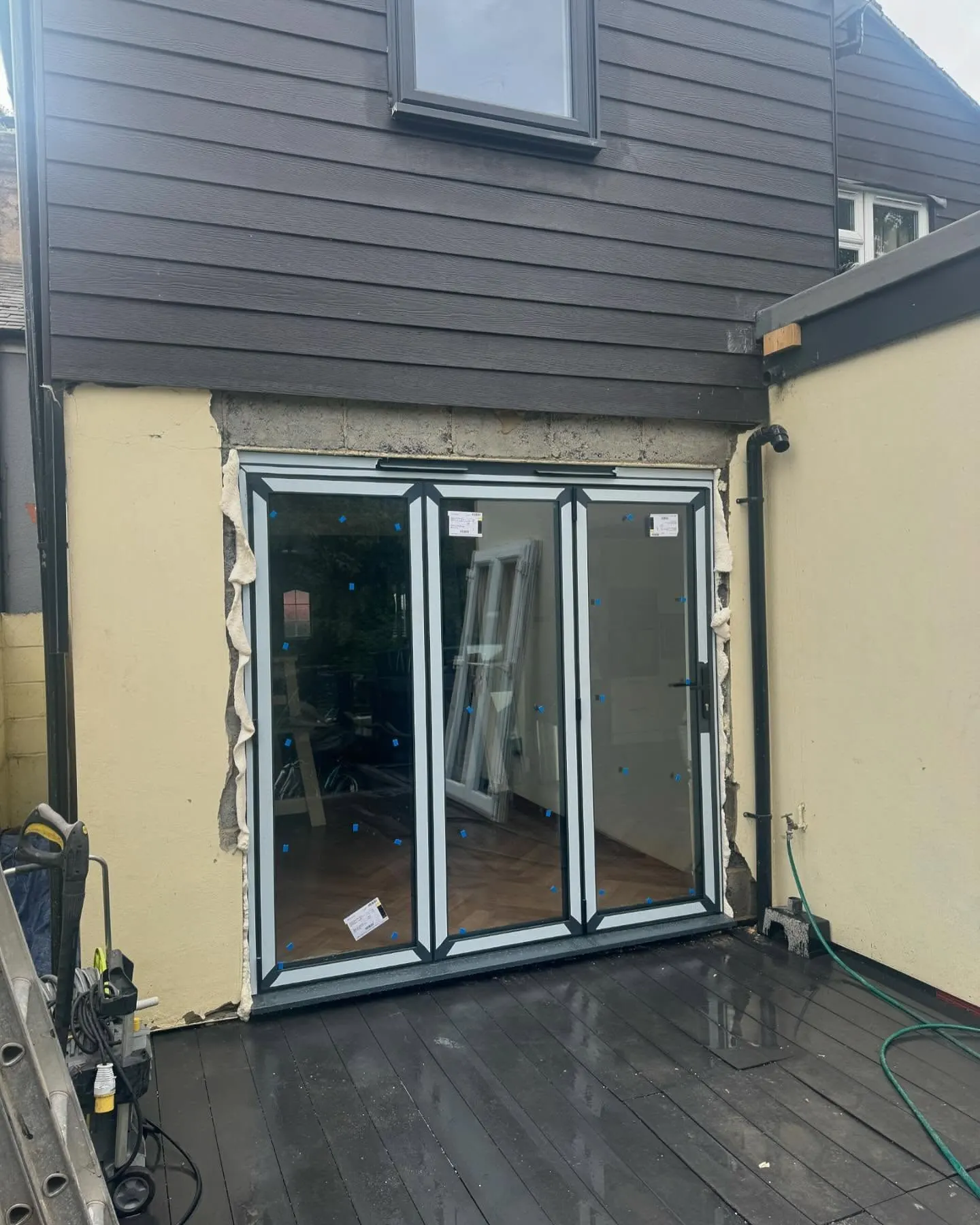
What the back of the house was, and is.
One of ours mid build and finished. No staging, and no borrowed images. Drag to reveal.
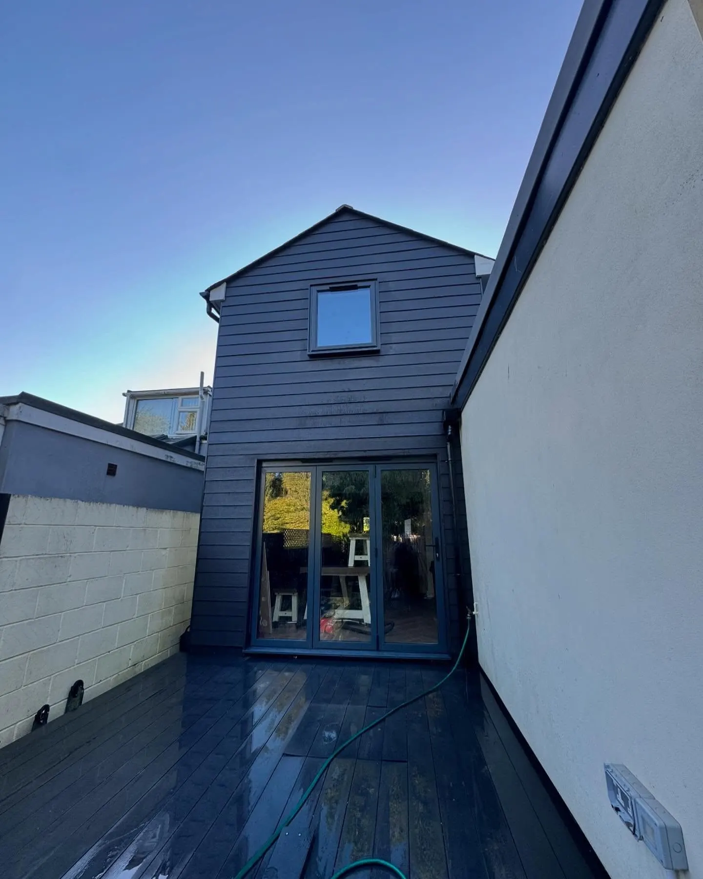
 During
Finished
During
Finished