
Extensions in St Osyth
One parish holding a designated priory village and a low-lying holiday coast, with more layers of designation than anywhere near it.
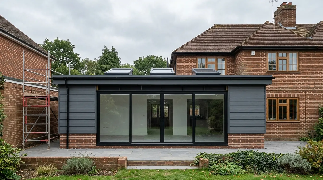 Fig. 01
Extending in St Osyth
One parish, two settlements that have almost nothing in common, and more layers of designation than anywhere else within ten miles.
St Osyth sits on a creek off the Colne, out past Alresford on the way to the Clacton coast. It is a village rather than a suburb of Clacton, and the distinction is not sentimental: the parish contains a designated historic village around a priory, and separately, down at the shore, the twentieth century holiday coast at Point Clear. Extending a house in one has very little in common with extending a house in the other.
What both share is the paperwork. If you are counting designations, this is the most heavily overlaid settlement on this stretch of coast, and the order in which you check them decides how long the front end of your project takes.
The authority, and what the application is decided against
Tendring District Council, the Local Plan, and a parish plan that is not the same thing as a neighbourhood plan.
The planning authority is Tendring District Council, not Colchester, despite the Colchester postal address that some of the parish carries. Applications are determined against the Tendring District Local Plan 2013 to 2033 and Beyond, Section 1 adopted in January 2021 and Section 2 in January 2022, together with the Essex Design Guide as supplementary guidance.
St Osyth has a parish plan dating from 2004. That is a useful document about what the village wants and it is not part of the statutory development plan. Neighbouring Alresford and Ardleigh have made neighbourhood plans, which are, and the difference is real: a made neighbourhood plan is something an application is decided in accordance with, while a parish plan is at most background. Nobody should be arguing a St Osyth application on the strength of the parish plan and expecting it to carry statutory weight.
The conservation area, and two Article 4 directions
The designation removes the usual rights; the directions remove more, in two specific places, and they are forty years apart.
The village is one of Tendring’s twenty conservation areas. Inside it the property becomes article 2(3) land, which takes away side extensions, two storey rear extensions and cladding as permitted development, closes off the prior approval route for a deeper single storey rear extension, and removes roof dormers, since Class B does not apply on that land. Rooflights fall under Class C, which has no such exclusion, so one sitting within 150 millimetres of the plane of the slope and no higher than the ridge remains permitted development unless a direction says otherwise.
And here, directions do say otherwise in places. Tendring has an Article 4 direction over land at The Bury, made in December 2007, and a much older one over land at Cow Lane, Point Clear, dating from 1972 under the general development order of the day. Two directions in one parish is unusual for this district, and it is exactly the sort of thing that never shows up on a general search of the village name.
An Article 4 direction switches off named permitted development rights over a mapped area. It does not stop the work, it converts it into a planning application, and it carries the ordinary householder fee: the exemption that used to apply where a direction was the only reason for applying was repealed in England in January 2018. Our guide to Article 4 directions explains the four ways to check whether one sits over your address, which is worth doing here rather than assuming.
The priory, and what setting means
A scheduled monument and a registered park sit in the middle of the village, and their setting reaches beyond their boundary.

St Osyth Priory was founded as an Augustinian house early in the twelfth century. The remains are a scheduled monument, the gatehouse is listed at the highest grade, and the park around it is a registered park and garden running to roughly 95 hectares. The whole group has been on Historic England’s heritage at risk register.
For a householder that is background until it is not. Scheduled monument consent is a separate regime from planning permission, administered nationally rather than by the district, and it bites on works to the monument itself. What reaches further is setting. An application for a house that stands within sight of a designated heritage asset is assessed for its effect on the asset’s setting, whether or not the house itself is designated, and the council routinely takes heritage advice on those. It does not make an extension unlikely. It makes the drawings, the materials and the roof form the argument rather than an afterthought.
Listed buildings, and the belief that costs people most
There are a lot of them here, and almost everyone is wrong about what listing does to permitted development.
The village has a substantial cluster of listed buildings, concentrated along The Bury and Mill Street and around the priory. If yours is one of them, the single most repeated misunderstanding in this trade is that listing strips out permitted development rights. It does not. Listing adds listed building consent as a second regime running alongside planning, under separate legislation, and unauthorised work is a criminal offence rather than a planning breach.
In practice that second consent is much the harder of the two, which is why people assume the first has gone. It also reaches inside the house, where planning does not: replacing a staircase, opening up a partition, changing internal joinery. And it can reach next door, because a structure within the curtilage of a listed building and predating 1948 can be treated as listed itself, which catches outbuildings, garden walls and old garages. Our page on extending a listed building goes through both regimes.
The trees are protected twice over
The conservation area appraisal counts around twenty two Tree Preservation Orders inside the designated area alone.
That density is high, and it comes on top of the general rule. Inside a conservation area, any tree of reasonable size that is not already covered by an order still cannot simply be worked on: you serve the council six weeks’ written notice of what you intend, and during that period it can make an order to stop you.
Six weeks is a long time to discover at the wrong moment. If a tree needs pruning to get plant round the side of the house, or a root is in the way of a foundation line, that notice wants serving at the same time as the drawings go in and not when the digger is booked.
Removing a mature tree to escape a deep foundation is rarely the shortcut it looks like anyway. Ground that has been dried by a tree for decades takes the water back when the tree goes, and swells. Heave acts upwards and does more damage than settlement does. There is more in our guide to tree preservation orders and foundations.
The creek, the marsh and Point Clear
The tidal flood zone follows the creek and the low ground; the village core stands above most of it.

St Osyth Creek runs up off the Colne past the mill and the dam, with marsh either side, and the tidal flood zone follows that low ground out to Point Clear and the shore. Point Clear itself is a different kind of place from the village: twentieth century chalet and holiday development that has partly become permanent housing, on flat ground close to the water, with caravan and park home sites alongside it.
If you are extending down there, flood level is a design input from the first sketch rather than a box ticked at the end. A householder extension counts as minor development, so the sequential test is not applied to it, and the work goes into the construction: finished floor level set deliberately, a solid floor, materials low down that will dry out, services kept up rather than run along the skirting. Our guide to flood zones and extensions in Essex has the detail.
Both the village edges and much of the coast here also fall within the Local Plan’s Coastal Protection Belt, which protects the open character of the undeveloped coastline. Officers do apply it to householder applications outside the settlement development boundary, here and along the coast at Brightlingsea. An extension to a house that already exists normally satisfies it, but scale and siting get justified rather than assumed.
The coastal payment that does not apply to you
This is the most expensive misunderstanding on the Essex coast, and it is worth being blunt about.
The Essex Coast Recreational disturbance Avoidance and Mitigation Strategy requires a per dwelling contribution from residential development inside its zone of influence, which covers this parish. People hear that and assume a coastal extension attracts it.
It does not. The tariff is triggered by a net increase in the number of dwellings. An extension to an existing house creates no additional dwelling, so it falls outside the strategy entirely. Where it can bite is at the edge of the annexe question: an outbuilding or annexe genuinely capable of independent occupation as a separate dwelling is a different proposition from an annexe ancillary to the main house, and the line between the two is worth understanding before the drawings are done rather than after. We cover it in whether someone can live in a garden annexe.
Ground conditions
Not uniformly clay, which is more of a problem than it sounds.
London Clay underlies the parish, and where it is at the surface it behaves the way Essex clay always does: shrinkable, sensitive to trees, foundations starting around 900 millimetres to 1.2 metres on a clear plot and going considerably deeper near anything mature. Parts of the parish are capped with terrace sand and gravel, and the low ground by the creek carries alluvium and soft deposits.
Three different grounds inside one parish means the foundation cannot be priced from an average. It is established by trial hole, and on the softer ground by a proper site investigation, before anyone commits to a depth. Our guide to extension foundations covers what each type is actually solving.
What people build here
In the village, careful and small. Down at the water, practical and raised.
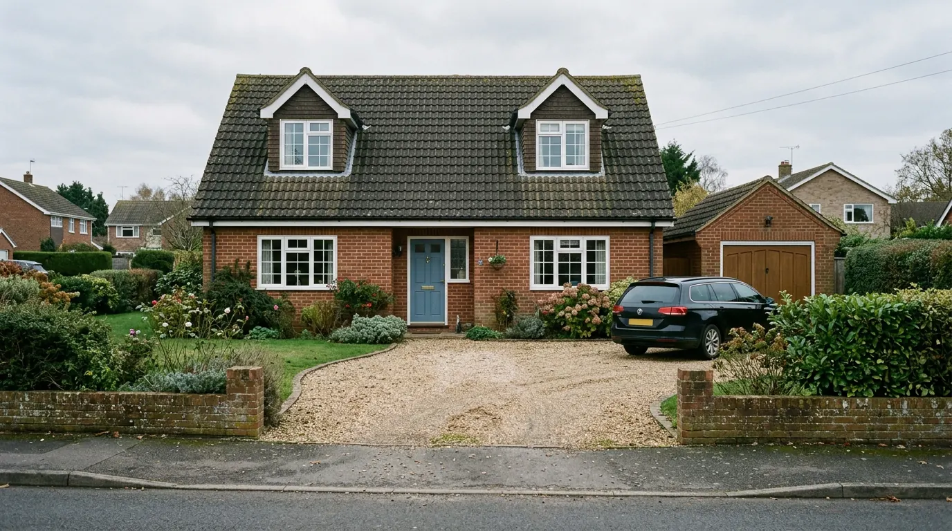
Village work is rear extensions detailed to sit with the existing building. Internal reconfiguration inside constrained plans is the other half of it. Garden rooms and outbuildings get set away from the main elevation, and roof work keeps to the back. Materials matter more than square metres, and the applications that go smoothly are the ones that answered the material question on the drawing.
Out towards Point Clear it is a different brief: adding a proper room and a proper roof to houses that started life as something lighter, garage conversions, and extensions designed around a floor level rather than around a view.
Questions we get asked in St Osyth
Do I apply to Tendring or to Colchester?
Tendring District Council. The postal address is not the planning authority, and applications sent to the wrong council do not get refused, they get delayed.
My house is listed. Have I lost permitted development?
No. Listing adds a separate consent rather than removing your Part 1 rights. It is a stricter regime and it covers the inside of the building, so most work needs it, but the two run alongside each other.
Will I have to pay the coastal mitigation tariff?
Not for an extension. It is charged on a net increase in dwellings, and extending your own house does not create one.
There is a big tree near where I want to build. What now?
We check whether it carries an order, and inside the conservation area we allow six weeks for the notice period regardless. Then the foundation gets designed around the tree rather than the tree removed to suit the foundation.
Getting a price for a St Osyth extension
We are based in West Bergholt, and St Osyth is a straightforward run round from Colchester.
Our team comes out and works through the things that actually set the number here: which designations touch your address, what the walls are built of, where the trees are, what the ground turns out to be when you open it, and what level the floor needs to sit at. Most people who call us already have drawings and permission and want a builder to price the work and build it. That is the ordinary job here, and we are glad to work to somebody else’s plans. Where the drawings do not exist yet, we bring in the technician who draws it and the structural engineer we work with to calculate it, we handle the application with Tendring District Council, we notify Building Control, and we run the job as main contractor.
We carry £2m public liability cover and build to current Building Regulations, through to the completion certificate. The survey and the quotation cost nothing.
Last reviewed August 2026.
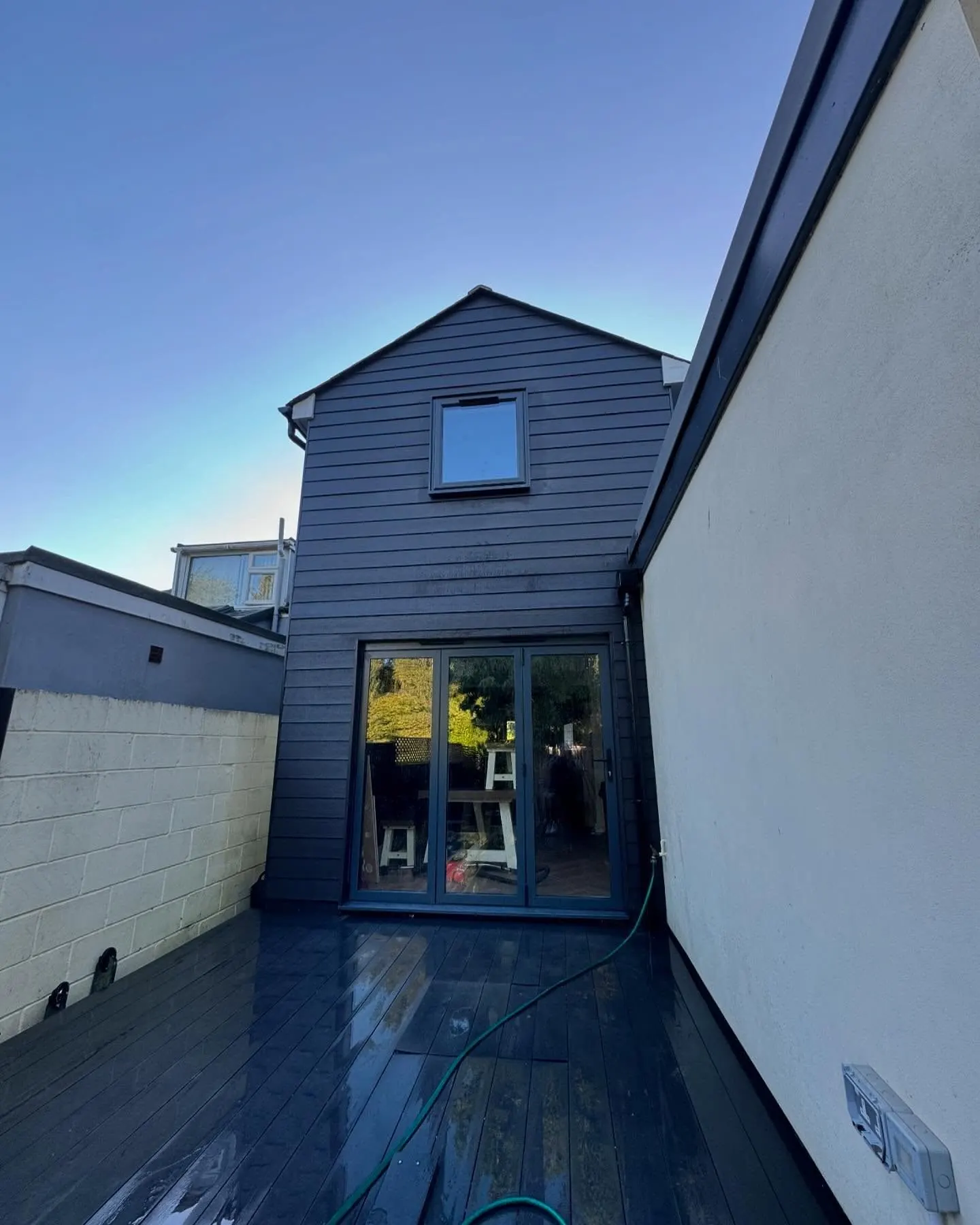
What the back of the house was, and is.
One of ours mid build and finished. No staging, and no borrowed images. Drag to reveal.
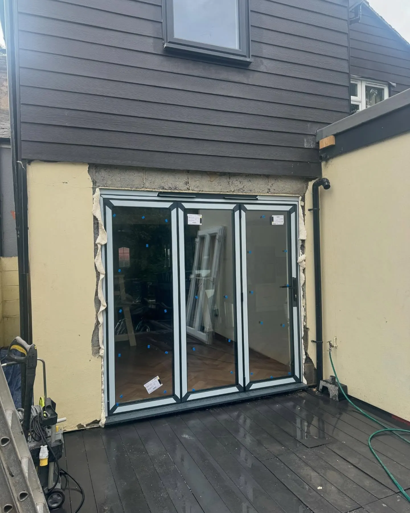 During
Finished
During
Finished