
Extensions in Brightlingsea
A working Colne port at the end of one road, where two conservation area boundaries and a coastal policy decide the shape of the job.
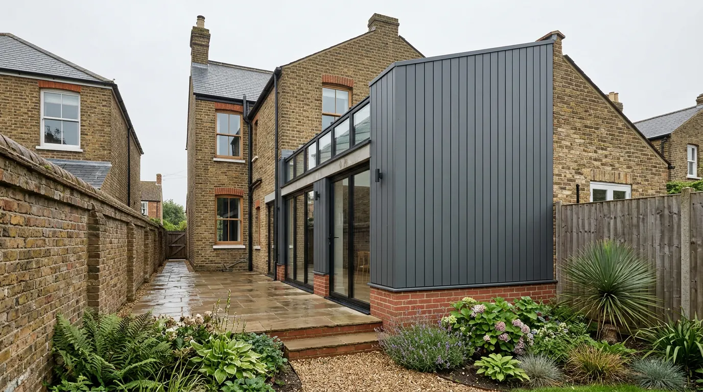 Fig. 01
Extending in Brightlingsea
A working town at the end of a single road, with two conservation areas, a tidal waterfront and a coastal policy most people have never heard of.
Brightlingsea stands at the mouth of the Colne, south east of Colchester, with a 2021 parish population of 8,680. It has been a port for a very long time and it is still a working one, with a harbour, a boatyard trade and a fleet that goes out. It is also the only Cinque Port limb outside Kent and Sussex, a limb of Sandwich, which has no bearing on planning and everything to do with why the town has never thought of itself as a suburb of anywhere.
That matters practically. Brightlingsea is not a village that grew off the back of Colchester and it is not part of the Clacton conurbation. It has its own centre, its own stock and its own constraints, and the constraints are unusually specific.
One road in
The B1029 from Thorrington is the only vehicular way into the town, and every load comes down it.
Brightlingsea sits on a spur of land between the Colne and Brightlingsea Creek, and the road network reflects that. There is one route in and the same route out. It is a perfectly good road, but there is no alternative to it.
For a building job that has two effects. Deliveries have to be sequenced rather than assumed, because a concrete wagon, a timber lorry and a grab lorry all arrive by the same lane through the same junction, and a booking missed in the morning is not easily recovered in the afternoon. And when the B1029 is closed for works, which it periodically is, the diversion is long enough to be a genuine cost rather than an inconvenience.
None of that stops anything. It means a Brightlingsea programme is planned around delivery slots more tightly than one in Stanway, and a builder who has never worked down here tends to find that out in week two.
Two conservation areas, and the ground between them
Tendring has designated the town centre and the church separately, and there is a mile of undesignated town in the middle.
The planning authority is Tendring District Council. Of the district’s twenty conservation areas, two of them are here. Brightlingsea covers the historic town, with distinct characters along the High Street, around Victoria Place, and through Queen Street and Regent Road. Brightlingsea Hall and All Saints Church is a separate designation covering the church and hall on the higher ground to the north, a good distance from the town centre.
The gap between them is the part worth knowing. A great deal of Brightlingsea, including nearly all of the twentieth century housing, lies outside both. So the question is not whether Brightlingsea is a conservation area, it is which side of two boundaries your particular address falls, and the answer is not guessable from the street.
Inside either designation the property is what the legislation calls article 2(3) land. Side extensions, two storey rear extensions and cladding all stop being permitted development, the prior approval route for a deeper single storey rear extension is not available, and a roof dormer needs planning permission because Class B does not apply on that land. Rooflights are governed separately under Class C and generally survive, sitting within 150 millimetres of the plane of the slope and no higher than the ridge. Our page on conservation areas and extensions covers how those applications get argued.

No Article 4 direction is recorded over the town, so what a designation removes here is what the designation itself removes and nothing further. That is worth confirming against your own address rather than taken on trust, since directions are published by each authority in its own time.
The housing stock
Victorian terraces built for a fishing and shipbuilding town, and a much larger layer of post-war housing behind them.
The old core is timber frame and soft red brick, with Jacobes Hall in the middle of it and a scatter of listed buildings around the High Street. The nineteenth century is what gives the town its shape: streets of terraced and small semi detached houses put up while the oyster trade and the smack fleet were at their height, in local brick, often with slate roofs, on narrow plots with shallow rear yards.
Those terraces have the familiar problem and the familiar opportunity. Rear access is frequently a gate or nothing, so materials and spoil go through the house along a protected route, which is slower and dearer. Against that, many have a rear wing with a side return beside it, and filling that strip is the single most effective thing you can do to a house of that plan. Solid walls, shallow footings and shared party walls all come with it.
The larger part of the town by number is post-war. Brightlingsea grew substantially through the second half of the twentieth century as Colchester commuting took over from the water, and those streets hold hipped semis with side access, 1960s and 1970s detached and link detached houses with integral garages, and estate housing on tighter plots. Trussed rafter roofs are the norm on anything from the mid 1960s on, which is the thing that decides whether a loft conversion is an adaptation or a rebuild.
The hard, the creek and the flood zone
The low ground at the waterfront is in the tidal flood zone; the town on the rise behind it mostly is not.
Brightlingsea Creek and the Colne are tidal, and the flood risk here is tidal rather than fluvial. The waterfront, the hard, the harbour and the promenade sit on low ground within the zone. Behind them the land rises, and the bulk of the housing is above it.
So flood risk is a question for particular addresses rather than the default condition of the town, and it is answered by checking the map on your property. Where it does apply, a householder extension counts as minor development, so the sequential test is not applied to it and the response is in the construction rather than the paperwork: finished floor level set deliberately, a solid floor rather than suspended timber, materials low down that will dry out, and sockets and consumer units kept up instead of run along the skirting. There is more in our guide to flood zones and extensions in Essex.
The Coastal Protection Belt
A Local Plan policy that genuinely does get applied to householder extensions here, and almost nobody expects it.
Tendring’s Local Plan carries a Coastal Protection Belt policy protecting the open character of the undeveloped coast. It is not a designation people associate with adding a kitchen to the back of a house, and it is quietly one of the more useful things to know about building on this side of the district, St Osyth included.

The reason is that plenty of Brightlingsea property sits outside the defined settlement development boundary and inside the belt, particularly on the approaches and out towards the water. Officers do assess householder extensions against it, and the test they apply is whether the proposal harms the open character of the belt, alongside whether it has a genuine functional reason to be where it is. An extension to an existing house normally clears that comfortably, because extending a house that is already there is exactly the sort of operational reason the policy contemplates.
What it does mean is that scale and siting are argued rather than assumed on those plots. A modest, subservient addition reads very differently from something that doubles the footprint on an open frontage, and the difference shows up in the officer’s report.
The neighbourhood plan is not made yet
Brightlingsea has one in preparation, which is a different animal from one that has been adopted.
A neighbourhood plan that has passed referendum and been made is part of the statutory development plan, and applications are determined in accordance with it. One that is still emerging is a material consideration whose weight depends on how far it has got.
Brightlingsea’s is in preparation. The practical reading for a householder is that the Local Plan and the Essex Design Guide are what your application will actually be measured against today, and that the position may change during the life of a project that runs over a year or two. It is worth a look at where the plan has reached before an application goes in rather than after.
Ground, made ground and the brick problem
Clay on the rise, something less predictable at the water, and a local brick that no merchant stocks.
The higher ground is London Clay, shrinkable and sensitive to trees in the usual Essex way, which puts foundations on a clear plot somewhere around 900 millimetres to 1.2 metres and a good deal deeper near anything mature. Our guide to trees and foundations covers how that distance is worked out.
Down at the waterfront it is different. Alluvium, and centuries of yards, hards and hardstanding on top of it, which means made ground of uncertain depth in places. Made ground is solvable but it has to be found, because it settles under load in a way undisturbed ground does not, and the answer is usually to found through it rather than on it.
Then there is the brick. Brightlingsea made its own bricks for a long time, and the older stock is built from them. They are not a modern stock size, they are not a modern colour, and nothing off a merchant’s pallet matches them straight. On a visible elevation the realistic options are reclaimed brick, a careful special order, or designing the addition to read as a deliberate contrast instead. Our guide to matching brickwork sets out what actually works.
Party walls, because so much of the town is joined
On the terraces this is not a courtesy, it is a statutory process with fixed clocks.

Cutting into a shared wall, building up to the boundary line, or excavating within three metres of a neighbour’s structure and below the level of their foundations all require formal notice under the Party Wall etc. Act 1996. On Victorian terraces with shallow footings, that last trigger fires far more often than people expect, because the new foundation is deep and the old one is not.
Notice periods are one or two months depending on the section, running from service rather than from when everyone becomes agreeable. A neighbour who consents in writing can shorten it. Silence cannot. Started early it is routine paperwork, and served the week before you wanted to dig it is simply a delay. The mechanics are in our guide to the Party Wall Act.
What people build here
The brief follows the stock, which is why the two halves of the town build different things.
In the old streets it is side return and rear infill work, with internal reconfiguration alongside it. Loft conversions here are designed to be quiet from the pavement. On the post-war housing it is the familiar pattern: single storey rear extensions opening the back of the house into a kitchen, hip to gable and dormer conversions, and garage conversions where the integral garage has not held a car in years.
Questions we get asked in Brightlingsea
Is Brightlingsea a conservation area?
Parts of it are, under two separate designations, and a large part of the town is in neither. We check the boundaries against your address first, because it decides whether the route is a certificate or an application.
Am I in the Coastal Protection Belt?
Possibly, if you are outside the settlement development boundary. It rarely prevents an extension to an existing house, but it does mean scale and siting have to be justified in the application rather than assumed.
Does the single access road really affect the price?
It affects the programme more than the price. Deliveries get booked tightly, and a job that needs several concrete pours is planned around that rather than around the calendar.
How is this different from Wivenhoe, across the water?
Different authority, for a start: Wivenhoe is Colchester City Council and Brightlingsea is Tendring District. Different conservation area boundaries, different local plan policies, and a road journey the long way round. We cover the other side in extensions in Wivenhoe.
Getting a price for a Brightlingsea extension
We are based in West Bergholt, and Brightlingsea is a run down the B1029 rather than a postcode on a coverage list.
Our team comes out and looks at the things that actually set the number: which conservation area boundary you are near, whether the ground is clay or made ground, what the wall is built of and what the roof structure is, where the drains run, and how a lorry gets to the back of the house. Most people who call us already have drawings and permission and want a builder to price the work and build it. That is the ordinary job here, and we are glad to work to somebody else’s plans. Where the drawings do not exist yet, we bring in the technician who draws it and the structural engineer we work with to calculate it, we handle the application with Tendring District Council, we notify Building Control, and we run the job as main contractor.
We carry £2m public liability cover and build to current Building Regulations, through to the completion certificate. The survey and the quotation cost nothing.
Last reviewed August 2026.
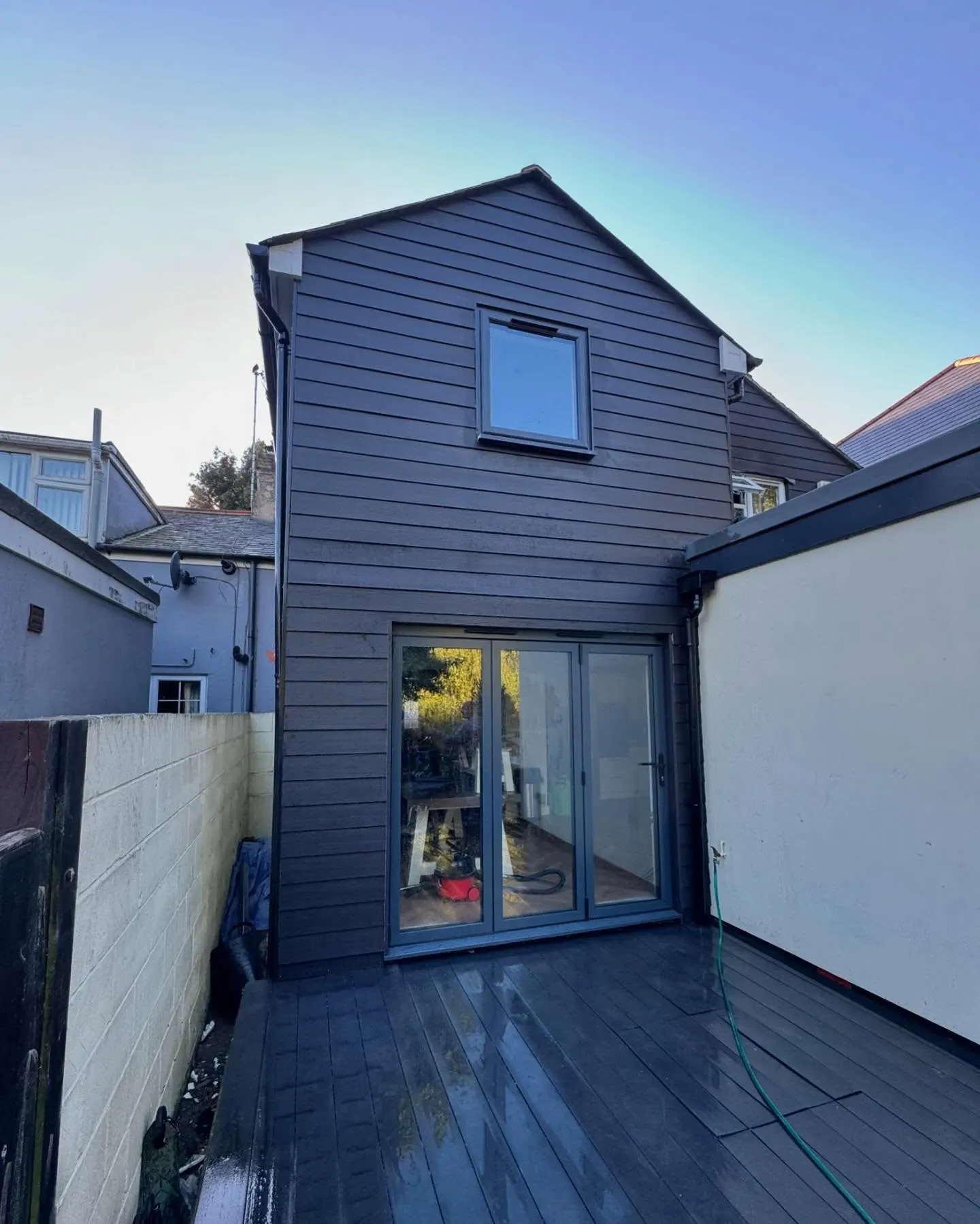
The same wall, before and after.
A two storey rear addition on a job in the Colchester area, photographed as it went. Drag to reveal.
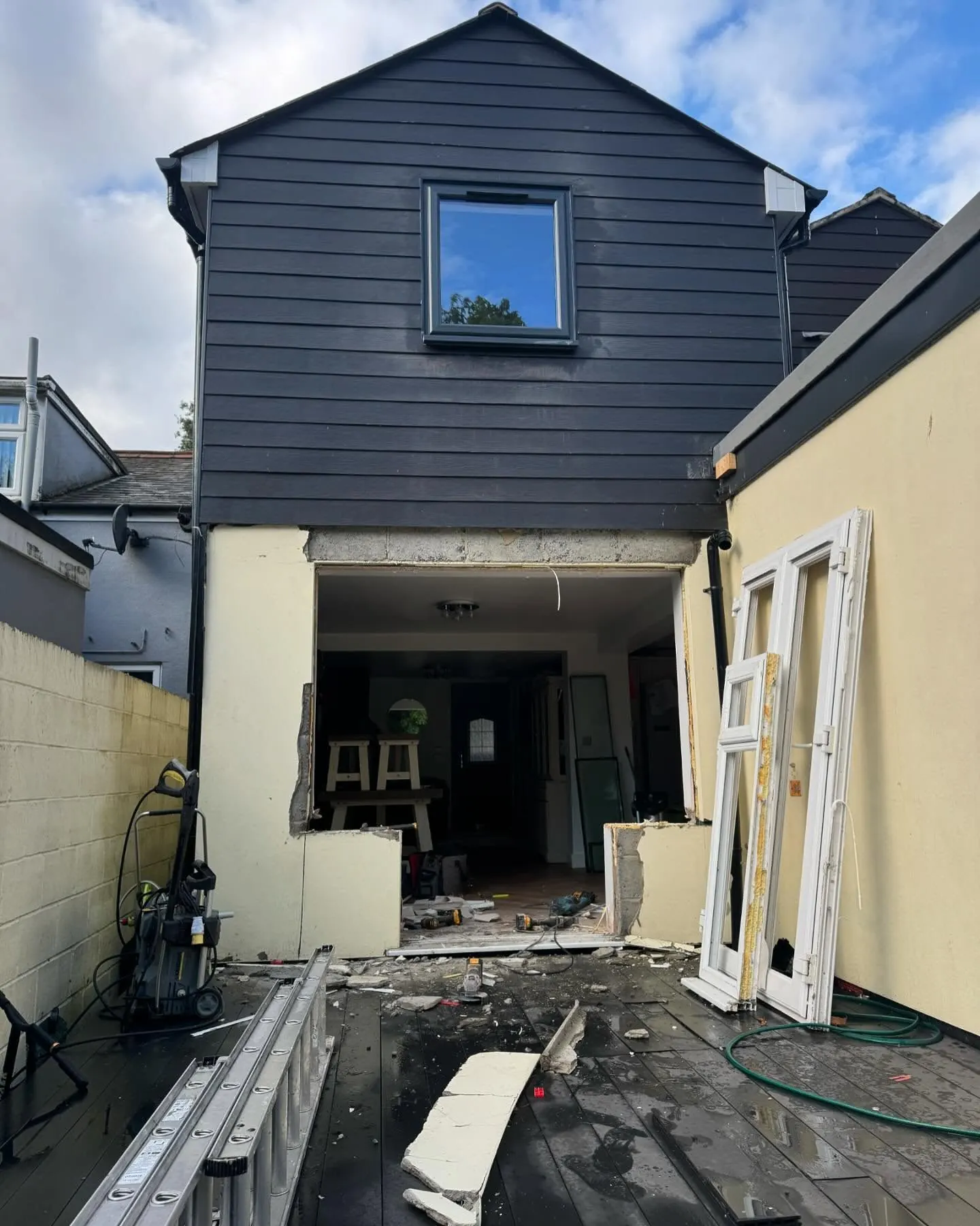 During
Finished
During
Finished