
Extensions in Ipswich
In a town with fifteen conservation areas and Article 4 directions layered over them, your address settles the job before the design does.
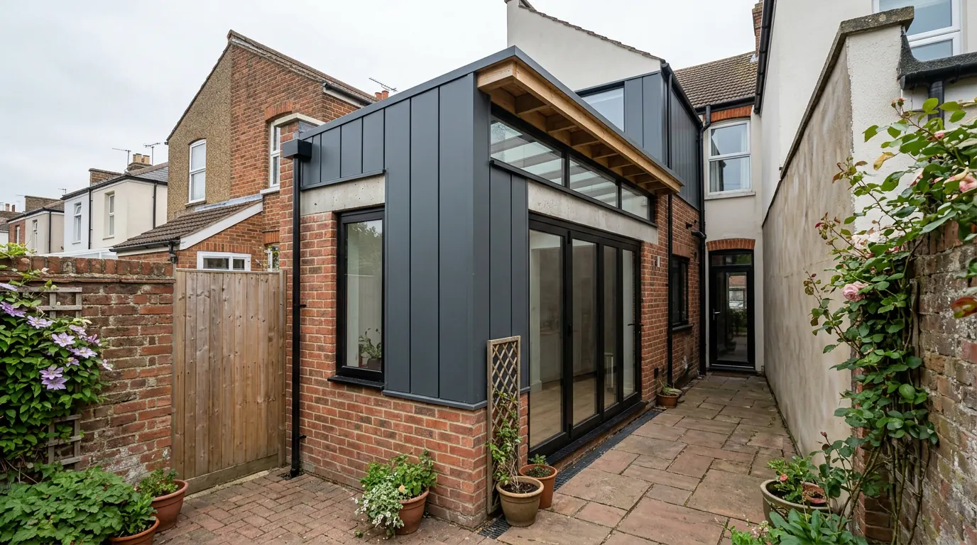
 Fig. 01
Extending in Ipswich
A town where the constraint changes street by street, and where knowing which street you are on is most of the job.
Ipswich is the largest place we work in, and it behaves differently from the villages around it. In a village you can usually describe the planning position in one sentence, because the whole parish sits inside or outside a single designation. Ipswich has fifteen conservation areas, several directions layered on top of them, and housing built continuously from the 1840s to last year. Two houses a quarter of a mile apart can be governed by completely different rules.
That is not a reason to be nervous about extending here. It is a reason to establish the position on your specific address before anybody draws anything, because the difference between a notification and a full application is weeks, and the difference between a permitted alteration and one that needs consent is the whole scheme.
Who decides
Ipswich Borough Council, and the borough boundary is drawn tighter than the built-up area is.
Applications in Ipswich are determined by Ipswich Borough Council, which is its own local planning authority with its own plan. The Ipswich Local Plan Review 2018 to 2036 was adopted on 23 March 2022 and is what a householder application is judged against, alongside national policy.
The catch is the boundary. The continuous built-up area spills well past it, so a house with an Ipswich postal address and an Ipswich phone number can sit in a different district entirely. Rushmere St Andrew and Kesgrave are East Suffolk Council. So is Martlesham. Sproughton and Pinewood are Babergh. The post office and the planning system disagree about where Ipswich ends, and only one of them determines your application. We check which authority holds your address before anything else, because it changes the fee, the forms and the policies.
Suffolk County Council is the highway authority, so a skip licence or a crossover comes from the county rather than the borough.
Fifteen conservation areas, and directions on top of them
The designation tells you which rights you have lost. The direction tells you which of the remaining ones have gone too.
The borough has fifteen designated conservation areas, and they were not all drawn at once. Henley Road dates from 1977, Barrack Corner from 1985, Stoke from 1987 and Whitton from 1990. Central, Christchurch Street, Norwich Road and Anglesea Road, Park and Holywells Park were all designated in 2003. Marlborough Road followed in 2015 and Burlington Road in 2020. If your house is inside one, side extensions and cladding lose permitted development status and the officer will look at materials and detailing rather than only at massing.
Roof work splits, and the split is worth understanding because it is where most people get it wrong. Under the general permitted development order, Class B covers enlargements of the roof such as dormers and is excluded on designated land, so a rear dormer inside an Ipswich conservation area needs permission. Class C covers other roof alterations and carries no such exclusion, so a rooflight in the plane of the slope generally remains permitted development, front slope included, provided it sits no more than 150mm beyond the plane of the original slope, goes no higher than the highest part of the original roof, and is obscure glazed and non-opening below 1.7 metres where it faces sideways. Our guide to extending in a conservation area sets out what the designation does and does not remove.
Sitting above that, the council publishes Article 4 directions of its own. The residential ones it lists cover the Norwich Road and Anglesea Road area, the Christchurch Street area including Constable Road and Gainsborough Road, numbers 1 to 51 Bolton Lane inside the Central conservation area, and Marlborough Road with Tolworth Road. What they remove is the right to alter elevations, roofs, windows and doors without applying. A window replacement that is nothing at all three streets away becomes an application here.
Whether a direction sits over your address is a question for the borough, and asking costs nothing. Our guide on Article 4 directions explains what the instrument is and how to check for one properly rather than assuming from the map.
The stock, decade by decade
Four distinct waves of housing, each with its own extension problem.

East of the centre is the district still called California, and it exists because of a single land sale. The Cauldwell Hall estate was bought and divided by the Ipswich and Suffolk Freehold Land Society, which took roughly 98 acres in October 1850 and cut it into 282 plots sold to members. The grid it laid out is still there: Freehold Road bisecting it, Cauldwell Hall Road and Britannia Road on the edges, with Howard Street, Milton Street, Kirby Street, Crabbe Street, Cowper Street, Bloomfield Street and Parliament Road between them.
The detail that matters on site is the brick levy. Until October 1850 bricks were taxed and therefore expensive, so the earliest houses here were built of flint rubble with brick only at the corners and around openings. Short terraces of it survive at 173 to 177 Cauldwell Hall Road and 9 to 13 Cowper Street. Most of the district is ordinary Victorian brickwork, but the early pockets are not, and a surveyor who assumes brick will price the wrong job.
The second wave is municipal. Building at Gainsborough started in 1926 and continued through the 1930s, two storey terraced and semi detached houses with real gardens and, on many plots, genuine side access. The third is Chantry, built mostly through the 1950s and 60s and one of the largest council estates in the country when it went up. Right to buy has put a great deal of both into private ownership, and they are now among the most extended houses in the town.
The fourth is Ravenswood, on the site of Ipswich Airport, which stopped operating at the end of 1996. Over a thousand homes have gone up there since, on modern plots with modern densities, trussed rafter roofs and integral garages.
What a flint rubble wall does to an opening
Random rubble has no course to needle into, and that changes how a beam goes in.
Forming a structural opening in a coursed brick wall is a well understood sequence: needles through the bed joints, props either side, cut the opening, drop the beam onto padstones, pin up. Flint rubble does not offer that. The stones are irregular, the bond is whatever the mason achieved on the day, and the mortar is usually lime, which behaves quite differently under load from cement.
What that means in practice is more temporary works, more care over where the bearing is formed, and often a padstone built up in brick or cast in concrete because there is no sound stone to land on. It also means the wall is solid rather than cavity, so where a new cavity extension meets it there has to be a proper detail for damp and for the cold bridge, rather than the standard junction. None of this is exotic. It is simply slower, and a price that has not allowed for it is a price for a different house. Our structural openings page covers how the beam and its bearings get sized.
Ground under Ipswich
There is no single Ipswich foundation depth, because there is no single Ipswich subsoil.
The town sits where several things meet. London Clay is present in the sequence beneath, the Red Crag, a shelly marine sand, comes to surface across parts of the district, and glacial sand and gravel caps a lot of the higher ground. The Gipping valley floor carries alluvium and river gravels, which is the same ground the valley gives at Needham Market.
The consequence is that the ground can change within a few hundred metres. On the clay you get the familiar shrink and swell behaviour, and a mature tree nearby drives the dig deep. On the crag and the gravels you get a granular soil that does not shrink, drains well and is generally kinder to a foundation, but which can run when a trench is open and which sometimes carries water. On an Ipswich plot the depth gets decided by a trial hole, not by what happened on the last job two streets away.
The waterfront, the barrier and the map
The defence protects the houses. It does not change the flood zone they sit in.
The tidal barrier on the Orwell opened in 2019, alongside roughly 1,100 metres of new and refurbished flood walls and a run of flood gates. It protects around 1,600 homes and several hundred businesses from tidal surge, and it is a serious piece of engineering.

Here is the part that surprises people. The Flood Map for Planning is drawn as though defences were not there, because the point of it is to show the underlying risk rather than the residual one. So the waterfront and the low lying land beside the estuary generally remain in Flood Zone 3 on the map that a planning officer opens, barrier or no barrier. For a householder extension that usually means a flood risk assessment, a conversation about floor levels, and construction detailing chosen so that water which does get in can get out again. Our guide to what a flood zone does to an extension explains how the sequential approach works. It is a solvable requirement, and it is not one you want to meet for the first time after committing to a design.
Access, parking and the neighbours either side
On a terrace there is no side gate, and both walls are shared.
Much of central Ipswich is terraced, which sets the logistics. Materials and spoil come through the house or down a passage barely wide enough for a barrow, waste goes into bags rather than a skip on the drive, and where a skip is needed it goes on the road under a county permit. That is a real cost line rather than a rounding error, and it should appear in a quotation.
Terraces also mean two adjoining owners rather than one. Cutting into a party wall, building up to the line, or digging within three metres of a neighbour’s structure below the level of their foundations all require formal notice, and on shallow Victorian footings that last trigger arrives more often than people expect. Notice periods run one or two months from service depending on which section applies, and the clock starts when notice is served rather than when everyone becomes agreeable. Our party wall guide sets out the sequence.
What people build in Ipswich
Four briefs, and which one you get depends almost entirely on your wave of housing.
On the Victorian terraces it is the rear infill: squaring off the L shape left by the original outrigger to make a single kitchen and dining space. On the interwar and 1950s semis it is a straightforward single storey rear extension, helped enormously by having side access. On both, loft conversions with a rear dormer are common, subject to the conservation area position. On Ravenswood and the other modern estates it is garage conversions and modest rear additions, where the limits are the plot and the original planning conditions rather than any designation.
Questions we get asked in Ipswich
My address says Ipswich. Is my application with the borough?
Not necessarily. The built-up area extends past the borough boundary into East Suffolk and Babergh, and the postal address does not follow the planning boundary. It is the first thing we confirm.
I am in a conservation area. Can I still put in a rooflight?
Generally yes, if it sits in the plane of the slope within the limits and no direction removes the right at your address. A dormer is a different matter and does need permission. The two are treated separately in the order.
The barrier protects my street. Does that get me out of the flood requirements?
No, because the planning flood map ignores defences by design. The requirement follows the mapped zone rather than the actual protection, which feels illogical until you consider what the map is for.
My walls are flint, not brick. Is that a problem?
Not a problem, but a different job. Opening up a rubble wall takes more temporary support and more care over the bearing, and that needs to be in the price rather than discovered halfway through.
Getting a price for an Ipswich extension
We are based at West Bergholt, straight down the A12 and A14, which puts most of Ipswich within half an hour of the yard.
Our team comes out and works through the things that actually decide the job: which authority holds the address, whether a designation or a direction sits over it, what the walls are built of, what the ground does when you open it, where the drains run, and what the flood map says. Most people who call us already have drawings and permission and want a builder to price the work and build it. That is the ordinary job here, and we are glad to work to somebody else’s plans. Where the drawings do not exist yet, we bring in the technician who draws it and the structural engineer we work with to calculate it, we handle the application with Ipswich Borough Council, we notify Building Control, and we run the job as main contractor.
We carry £2m public liability cover and build to current Building Regulations, through to the completion certificate. The survey and the quotation cost nothing.
Last reviewed August 2026.
What the back of the house was, and is.
One of ours mid build and finished. No staging, and no borrowed images. Drag to reveal.
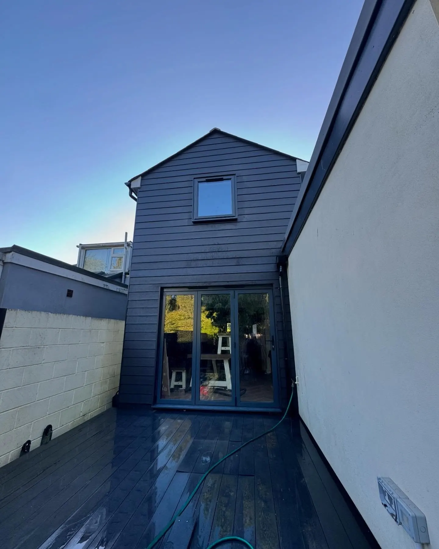
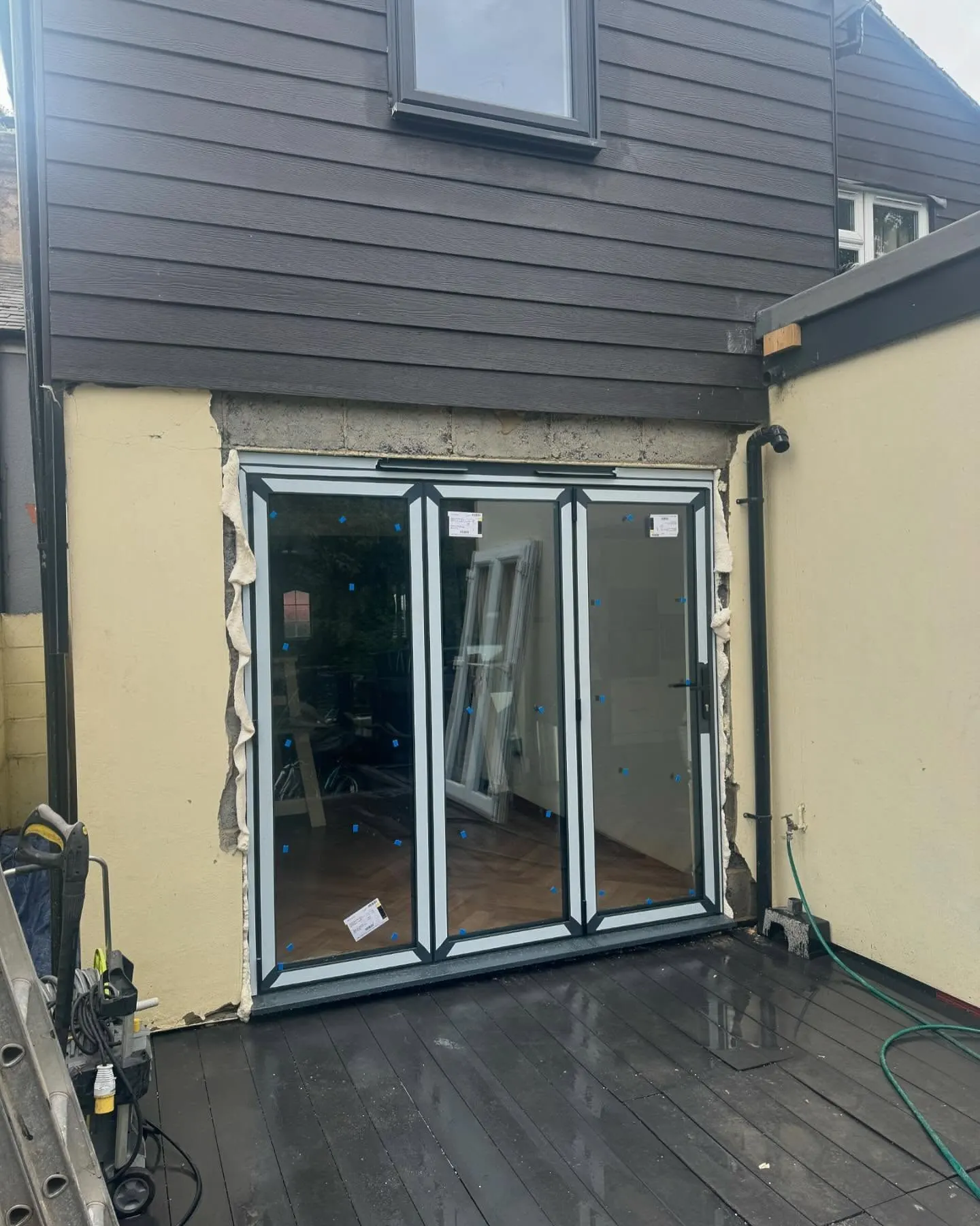 During
Finished
During
Finished