
Extensions in Bradfield
One village street crossing two designation boundaries, so the rights you hold change three times between the church and Bradfield Heath.
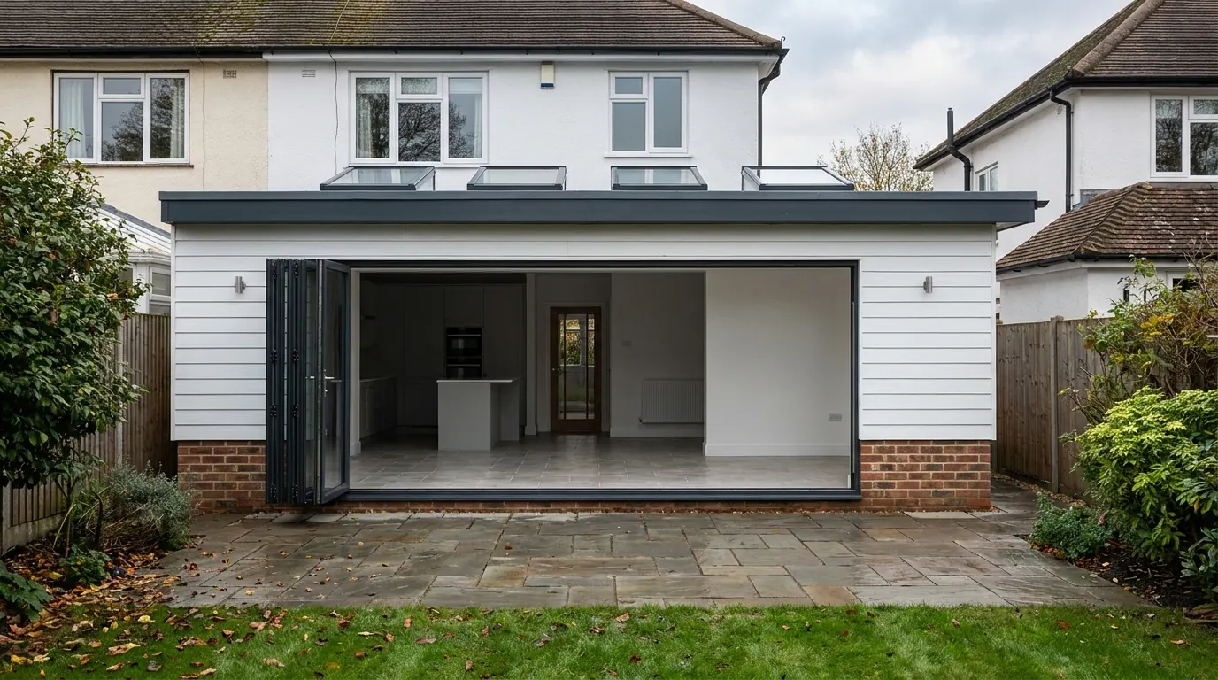 Fig. 01
Extending in Bradfield
One parish, one road, and three completely different planning positions along the length of it.
Bradfield is a linear village running north to south along The Street, from a T junction with the Harwich road at the top down towards Bradfield Heath at the bottom. It sits on a gravel ridge above the Stour estuary, about three miles east of Mistley, and the parish held 1,253 people at the 2021 census.
Drive that road from one end to the other and you cross two designation boundaries without seeing either of them. At the church you are inside a conservation area and inside a National Landscape at the same time. Halfway down you have left the conservation area but you are still in the National Landscape. By the Heath you are in neither, which is the position across the whole of neighbouring Wix as well. The permitted development rights you have are not the same in those three places, and nothing on the ground tells you which one you are standing in.
The authority
Tendring District Council, and no shared arrangement with anybody.
Applications are determined by Tendring District Council against the Tendring District Local Plan 2013 to 2033 and Beyond Section 2, adopted in 2022. The policies that come up most often on a householder application here are the ones on sustainable design, the rural landscape, archaeology, conservation areas and listed buildings. Bradfield Parish Council is consulted and does not decide.
The conservation area, and what the 2025 appraisal did to it
It covers the top of the village only, and the boundary has just moved.
The Bradfield Conservation Area was first designated in 1981, assessed in 2001, and reviewed in a document adopted in March 2006. A new Character Appraisal and Management Plan was produced in May 2025, and it is worth reading if the boundary runs anywhere near you.
The area is small and it is concentrated at the northern intersection: the Church of St Lawrence and its churchyard, the buildings facing it, and the top end of The Street. There are eight designated heritage assets inside it. The church is listed Grade II and its tower is twelfth century, with an octagonal font of the twelfth or thirteenth century. The others are more varied than that suggests: the crinkle-crankle wall running south of the church is listed in its own right, and so are a milepost and a K6 telephone kiosk, along with several eighteenth-century cottages.
The 2025 appraisal proposes taking property out of the conservation area as well as tidying it. Old Hall House on Harwich Road is removed, on the basis that it was built since the previous appraisal and its date, massing and appearance do not reflect the prevailing character. An outbuilding on Station Road associated with a modern house outside the boundary comes out too, and several stretches of the line are pulled back onto existing plot boundaries.
Two things follow from that. A conservation area boundary is not permanent, in either direction, so advice about your address wants a date attached to it. And the appraisal itself records that there are currently no Article 4 directions in place within the Bradfield Conservation Area, which is a helpful starting point but not a substitute for the council confirming it against your address.

The National Landscape, which reaches further than the conservation area does
This is the part that catches people out, because it is invisible and it does the same job.
In July 2020 the Suffolk Coast and Heaths area of outstanding natural beauty was extended into Essex along this bank of the Stour. It is now called a National Landscape, though the permitted development order still uses the older statutory term, and the northern part of this parish, including the village and the conservation area, sits inside it. Bradfield Heath, to the south, does not.
An area of outstanding natural beauty is article 2(3) land in exactly the same way a conservation area is. Inside it, Class A takes away side extensions, takes away a rear extension of more than one storey, takes away cladding, and closes the prior approval route that would otherwise allow a deeper single-storey rear. Class B, which covers roof enlargements, does not apply at all, so a dormer needs an application. Class C, which covers other roof alterations, has no such exclusion, so a rooflight sitting no more than 150 millimetres beyond the plane of the original slope and no higher than the highest part of the roof stays permitted development.
So a house halfway down The Street, with no listed neighbour and no conservation area anywhere near it, has the same restricted set of rights as a cottage facing the churchyard. And a house at the Heath has the full set, including the larger home extension route, which is covered on our page about larger home extension prior approval. Same village, same council, same road.
What the buildings are made of
Painted render over timber frame, red brick, and red plain clay tiles. There is exactly one weatherboarded building in the conservation area.
The eighteenth-century cottages at the northern end are timber framed, rendered and painted, which is the regional norm. Brick appears on the nineteenth-century buildings and on the higher-status ones: Bradfield Place, the late Georgian former vicarage east of the church, is formal brick with a slate roof set back behind a parapet, and the former public house at the junction is red brick with a mock timber-framed first floor from the turn of the twentieth century. Squires Cottage is weatherboarded at first floor level and the appraisal notes it is the only boarded building in the area. Roofs are red plain clay tiles, with gambrel forms and dormers adding variety, and chimneys doing a lot of the work in the street scene.
The appraisal is blunt about what has damaged the place, and it is not extensions. It is plastic windows and doors replacing timber ones, and porches added without reference to the building behind them. That is useful intelligence for anyone applying. A scheme that puts timber back where plastic went in is starting the conversation from a different place than one that does not.
One more thing worth knowing: Tendring has no approved local list. Buildings that are not listed but matter are identified in appraisals rather than on a register, and the judgement about whether yours is one of them gets made when your application is assessed. In Bradfield the appraisal names Bradfield Place, the former public house and the church lychgate as candidates.
The gravel ridge, and what it does to a foundation
This is not the clay story that governs most of Colchester, and that cuts both ways.

The conservation area, and the ridge the village sits on, is gravel above the estuary. The appraisal describes the lighter soils that produces, which is why people settled here in the first place. Gravel is generally a kinder foundation medium than shrinkable clay: it does not swell and shrink with the seasons, so the deep digs that mature trees force on a clay plot are less often the answer here.
What it substitutes is variability. Gravel deposits are not uniform in depth or density, they can be loose near the surface, and where the ridge thins the clay beneath comes back into play. A foundation designed on the assumption that the whole plot is the same as the trial hole nearest the house is a guess. On a site like this the dig gets checked as it opens, and the depth is confirmed rather than priced from an average. Our guide to extension foundations covers what each type is actually for.
What is in the garden before you dig it
On a settlement this old, the archaeology is in the plots behind the street frontage.
The parish has produced a Neolithic axe in mint condition, cropmarks of field systems across the surrounding fields, and Roman brick and tile reused in the fabric of the church. Within the conservation area the likeliest survivals are medieval and post-medieval: structures and finds along the street frontage, and in the gardens behind it the wells, cess pits and middens that every household needed before mains anything.
That is precisely the ground an extension excavates. On the gravels, bone survives poorly but flint, pottery, building material and metal survive well. It does not usually stop a scheme. It can produce a condition requiring a watching brief while the foundations are dug, which is a modest cost when it is planned and an expensive halt when it is not.
Fronting a classified road
There is no verge to work off at the north end of the village.
The buildings in the conservation area front the highway directly, and the road through them is a classified B route between Manningtree and Harwich rather than a lane. Scaffold standing over the footway needs a licence from Essex Highways, deliveries have to be timed rather than assumed, and a skip goes on the road with a permit unless there is a drive to put it on. Plots at the northern end are shallow, so material handling is through the building or over a boundary.
Down towards the Heath the pattern loosens: ribbon development with front gardens, driveways and space at the side. Access there costs very little, which is one more reason the two ends of the same village produce different quotations.
What gets built here
Small and traditional at the top, conventional at the bottom, and a designated middle that surprises people.

At the church end the work is modest rear extensions in matching materials, repair, and roof alterations kept to rooflights in the plane of the slope. Where a building is listed, listed building consent runs alongside planning as a separate regime that also covers the inside, and our page on extending a listed building explains why that is usually the harder of the two.
Through the middle of the village the briefs are ordinary, single-storey rear extensions and garden rooms, but the route is not: no side extension without permission, no dormer without permission, and no prior approval route for depth. At the Heath end the full toolkit is available and the constraints are practical ones instead. Our guide to conservation areas and extensions sets out which rights go and which survive.
Questions we get asked in Bradfield
I am not in the conservation area, so I can build a side extension. Correct?
Not necessarily. Most of the village north of the Heath is inside the National Landscape, which removes side extensions in the same way a conservation area does. It is worth checking both lines rather than one.
Can a property be taken out of a conservation area?
Yes. The 2025 appraisal removes a modern house on Harwich Road and rationalises several other stretches of the boundary. It works the other way too, so the answer you were given a few years ago may not be the current one.
Do I need deep foundations because it is Essex?
Not automatically here. The ridge is gravel rather than shrinkable clay, so the tree-driven depths that dominate around Colchester are less often the answer. It gets confirmed by opening the ground, not by postcode.
My windows are plastic. Does that count against me?
It is not a penalty. It is an opportunity, because putting timber back where plastic went in is treated as an enhancement, and a scheme that does it is a stronger application than one that does not.
Getting a price for a Bradfield extension
We are based in West Bergholt, and Bradfield is out past Mistley on the estuary road.
Our team comes out and establishes the things that actually set the number: which of the two boundaries your address falls inside, what the walls and roof are genuinely built of behind whatever has been done to them, how the ground behaves when it is opened, and how anything reaches the back of the house from a road with no verge. Most people who call us already have drawings and permission and want a builder to price the work and build it. That is the ordinary job here, and we are glad to work to somebody else’s plans. Where the drawings do not exist yet, we bring in the technician who draws it and the structural engineer we work with to calculate it, we handle the application with Tendring District Council, we notify Building Control, and we run the job as main contractor.
We carry £2m public liability cover and build to current Building Regulations, through to the completion certificate. The survey and the quotation cost nothing.
Last reviewed August 2026.
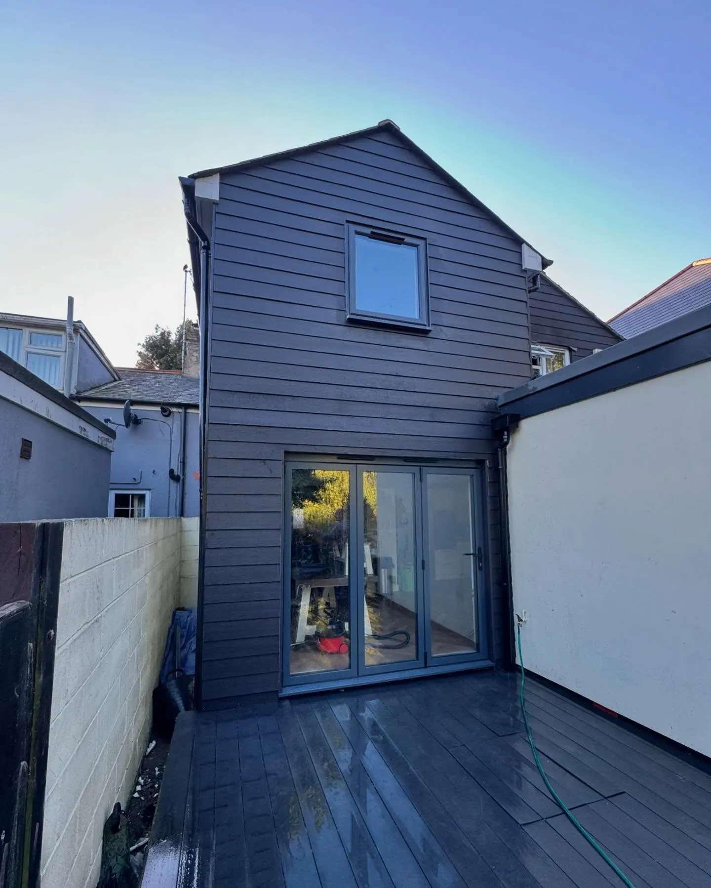
The same wall, before and after.
A two storey rear addition on a job in the Colchester area, photographed as it went. Drag to reveal.
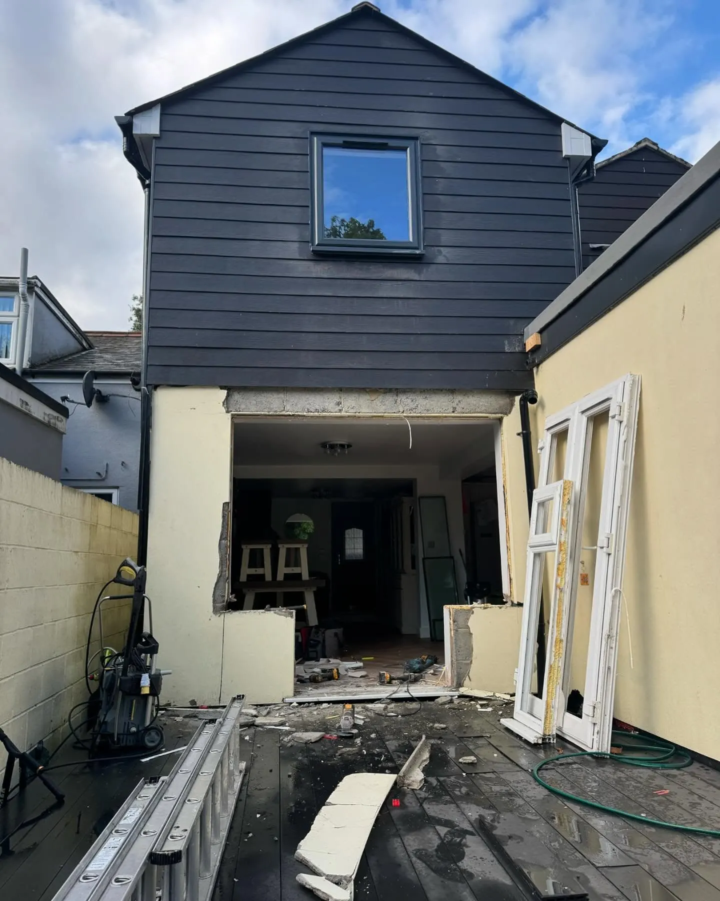 During
Finished
During
Finished