
Extensions in Kelvedon
A medieval town with a Roman one underneath it, and both of them decide what you can build at the back.
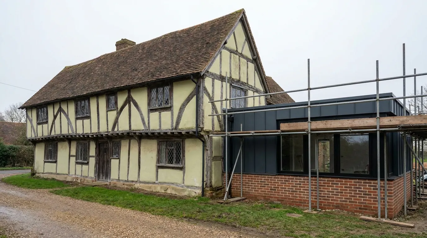 Fig. 01
Extending in Kelvedon
A small medieval town with a Roman one underneath it, and both of them affect what you can build in the back garden.
Kelvedon is not really a village. It is a linear medieval town strung along the line of the Roman road from London to Colchester, with two historic focal points at either end of the High Street rather than one. Under it lies Canonium, the Roman staging post between Londinium and Camulodunum, sited on a wide bend of the River Blackwater at the crossing.
That gives Kelvedon a specific combination: a long, densely listed conservation area along the main street, a large body of twentieth century housing behind it, and a river on one side that governs both flood risk and the ground.
Applications are determined by Braintree District Council. Kelvedon also has a made neighbourhood plan, adopted in July 2022, which forms part of the development plan the council decides against. That is not a veto held by the parish, but it is policy with statutory weight and it is worth reading before a design is fixed.
The conservation area, and where it goes
Designated in 1969, split into seven character areas, and it does not stop at the parish boundary.
The Kelvedon conservation area was designated on 19 June 1969 and was given a full character appraisal and management plan in 2020. It covers the length of the High Street and its junctions with Church Street, Maldon Road, London Road, Swan Street and Station Road.
The part people get wrong sits at the eastern end. The conservation area crosses the River Blackwater and takes in part of Feering Hill, which is in Feering parish, not Kelvedon. If your address is on Feering Hill, the designation you are inside may well be the Kelvedon one. The parish on your council tax bill is not the answer to that question, and it is the commonest confusion we hear on this stretch.
Inside the designation the practical effects are the usual ones and they are worth stating plainly. Conservation area status is designated land for permitted development purposes, so under Class A a side extension loses permitted development status, cladding does, and a rear extension of more than one storey does. Under Class B a dormer needs permission. Class C, which covers rooflights, is not excluded on designated land, so a rooflight in the plane of the existing slope remains permitted development unless an Article 4 direction removes it, and no such direction is recorded over the village. Have the council confirm that against your address; it costs nothing and a map that shows nothing is not the same as a written answer.
The 2020 appraisal did recommend that an Article 4 direction over front elevations be considered as a way of managing the loss of original features. That is a recommendation, not an instrument, and the position at your address is a question for the council today rather than for a document written in 2019.
What the buildings are actually made of
Pevsner described Kelvedon as giving an impression of gables rather than Georgian brick cubes, and that is the useful correction.

The town has a heavy listed-building density, headed by the Grade I listed 1 to 5 High Street, known as Templar Terrace, with several Grade II* buildings including the Sun Inn, Feering House, Easterford Mill, Old Timbers, Red House, St Mary’s House and Bridgefoot House. The rest are Grade II.
Most of the oldest buildings are timber framed with red plain tiled roofs. What you see from the street is usually their eighteenth or nineteenth century remodelling: a brick front, sash windows, a raised parapet. The majority of the timber framed buildings are rendered, historically in lime. Brick arrives in the eighteenth and nineteenth centuries, usually a soft red and sometimes gault, with slate roofs and red brick boundary walls to the larger properties.
The council’s appraisal records the historic paint palette as creams, buffs, pinks and ochres, and makes one point that surprises people: weatherboarding is largely a modern introduction here and is not in keeping, except on agricultural buildings and workshops. If you were planning to clad a rear extension in black boarding because it looks Essex, that is the paragraph to read first. It is a fair local rule, and it is the opposite of the answer in some villages a few miles away.
Where a building is listed, listed building consent applies as a second regime alongside planning. It does not remove the permitted development rights that govern extensions and roof work; it adds a separate consent, under separate legislation, that reaches inside the building and where unauthorised work is a criminal offence. See listed buildings and extensions for how the two run together.
Archaeology in the back garden
This is a real line in a Kelvedon budget, and it is specific to the ground here rather than to old houses generally.
Archaeological work has been going on in Kelvedon since the 1940s, concentrated on the Roman town. Large areas of it were destroyed or damaged by the development of the 1970s, but subsequent work has established that cut features and shallow stratigraphy survive in open areas within the present built-up town, and back gardens are named specifically. Waterlogged deposits can be expected close to the river and in deep features such as wells and cess pits.
What that means for an extension is that the county’s historic environment advisers may recommend a condition requiring evaluation, or a watching brief while the foundations are dug. That is a cost and a programme item, not a refusal, and it is far easier to carry when it was priced at design stage.
The soils vary and the appraisal notes it: brickearth in places, gravels in others. Brickearth preserves organic material well; the gravels are acidic and preserve it poorly. That distinction is archaeological, but it also tells you what your foundation is going into, which is the other reason to open a trial hole before anyone quotes a depth.
The river, and the flooding that keeps happening
The Blackwater has flooded this village three times in living memory, and the position of your plot matters more than the average risk.
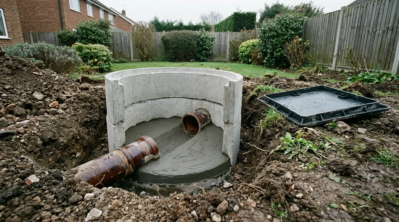
Kelvedon flooded significantly in October 2001, and again in May 2012 and February 2014. The Environment Agency has designed a flood alleviation scheme for Coggeshall, Feering and Kelvedon together, based on a dam and an extended flood storage area upstream. It is a designed scheme rather than a built one, and nothing about a proposed scheme changes the flood zone your plot sits in today.
Development on the southern side of the High Street runs down towards the flood plain, so the relevant question is not whether Kelvedon floods but where your garden sits on the fall. Where a plot is in a flood zone, floor levels, the choice between a suspended and a ground bearing slab, and sometimes the whole form of the extension follow from it. Our page on flood zones and extensions in Essex explains what the designation asks for.
The other Kelvedon: everything behind the High Street
Most houses in this village are not listed and not in the conservation area, and they have their own set of problems.
The land south of the High Street, over much of the Roman fort and town, was built out in the 1970s and 1980s. North of the High Street, the strip between it and the railway was infilled later in the twentieth century. Those are the two blocks of housing where most Kelvedon extensions actually happen.
Stock of that age is cavity walled with trussed rafter roofs and shallow strip footings, on plots laid out to a density. The advantages are real: predictable construction, usually side access, and a drainage layout that was recorded when it was laid. The constraints are the plot width and the roof. A trussed roof cannot simply be cleared out for a loft room, because every member in it is working; converting it means a new floor structure and a replacement roof, which is a genuine build. The loft conversions page sets out what is involved.
Outside the conservation area the full Class A rights apply rather than the narrowed version, so a side extension and a two storey rear are both on the table in a way they are not on the High Street. That is the single biggest practical difference between the two halves of this village.
Access on a High Street with no back lane
The medieval plots run back from the street, and a lot of them have no way in except through the house.
The buildings along the older parts of the High Street are packed tightly, many opening directly onto the pavement with jetties or bay windows crowding forward. Where there is no side passage, materials come through the building, spoil goes out the same way, and concrete is pumped rather than barrowed. Those are costs, and they belong in the quotation at the start rather than as a variation.
The street is also busy and the parking is contested, so a skip usually needs a permit and a delivery needs a time. None of that is unusual for a historic small town; what is unhelpful is a price that assumed a driveway.

What people build in Kelvedon
The village splits neatly, and so do the briefs.
Behind the High Street it is the single storey rear extension, the kitchen extension and the garage conversion, with the occasional two storey side addition where the plot is wide enough.
On the High Street it is careful work on old buildings: an existing rear outshot rebuilt properly, a kitchen taken into a wing that was never insulated, a roof and frame put right. Those jobs need lime rather than cement in the right places, an eye on breathability, and a structural engineer who has met a timber frame before.
Where a modern addition is the right answer on a historic house, the two defensible approaches are a frank contemporary piece that does not pretend, or a quiet subordinate one that lets the original read. What tends to fail is the middle: a reproduction that is neither the original nor honest about being new.
Questions we get asked in Kelvedon
I live on Feering Hill. Which conservation area am I in?
Possibly the Kelvedon one, even though your address is in Feering parish. The designation crosses the river. It is the first thing we check here.
Can I clad the extension in black weatherboard?
Inside the conservation area the appraisal treats weatherboarding as a modern introduction that is not in keeping, except on agricultural buildings. Outside it, it is an ordinary design choice.
Will I have to pay for archaeology?
Sometimes, depending on where you are and what the county’s advisers say. It is decided before permission is granted, so it can be priced rather than discovered.
Does the neighbourhood plan mean the parish decides?
No. The district determines the application. The neighbourhood plan is part of the policy it decides against, which is a different and more useful thing to design with.
Getting a price for a Kelvedon extension
Our team surveys the property before anything is drawn: the ground and what a trial hole is likely to show, the existing structure and whether the front wall is doing the work you think it is, the drain runs, the access, the flood position and the designation.
Most people who call us already have drawings and permission and want a builder to price the work and build it. That is the ordinary job here, and we are glad to work to somebody else’s plans. Where the drawings do not exist yet, we bring in the technician who draws it and the structural engineer who calculates it, we prepare and manage the application with Braintree District Council, we notify Building Control and we run the job as main contractor. On a listed building we handle the listed building consent alongside the planning application rather than treating it as somebody else’s paperwork.
We carry £2m public liability cover and everything is built to current Building Regulations. The survey and the quotation cost nothing.
Last reviewed August 2026.
What the back of the house was, and is.
One of ours mid build and finished. No staging, and no borrowed images. Drag to reveal.
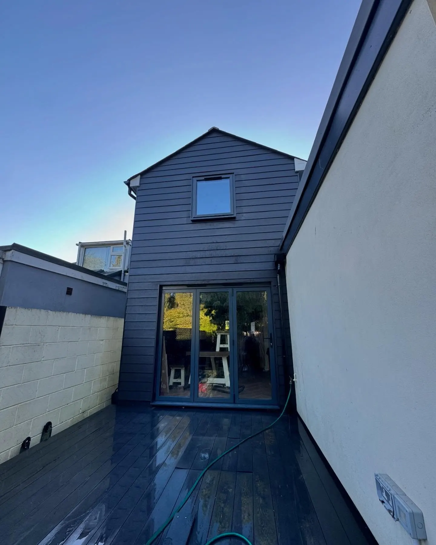
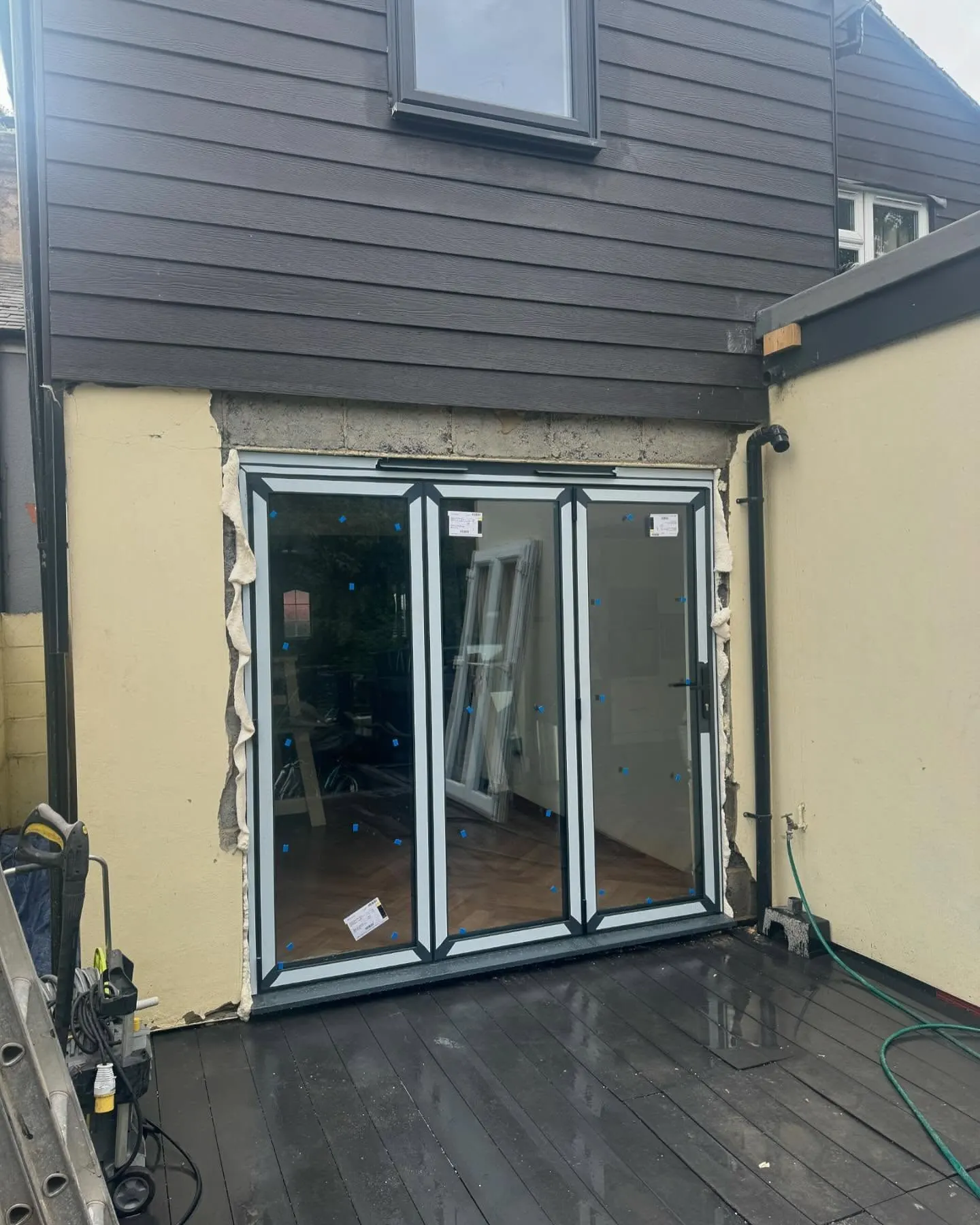 During
Finished
During
Finished