
Extensions in Brantham
A village built round a plastics works, where the year your house went up and the ground beneath it decide most of the price.
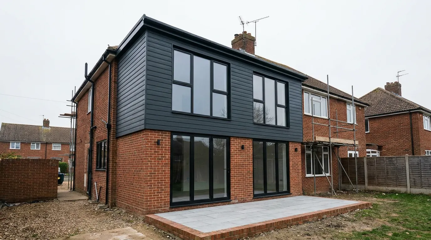 Fig. 01
Extending in Brantham
A village built round a factory, on London Clay, with a designated landscape crossing one end of it and a brownfield site being rebuilt at the other.
Brantham stands on the rising ground above the Stour, roughly two miles north of Manningtree and nine miles south west of Ipswich, with Cattawade and the estuary crossing below it. The 2011 census counted 2,566 people across about seven and a half square kilometres.
The village exists in its present form because of one company. In 1887 British Xylonite bought Brooklands Farm and built a works on the riverside land, then put up housing for the people who ran it. That decision set the shape of the parish, the shape of its housing stock, and the shape of the ground underneath a good deal of it, and all three still show up in a quotation.
Who decides, and why people get it wrong here
Babergh District Council, despite everything the postcode and the station suggest.
Brantham is a civil parish in Babergh, so applications are determined by Babergh District Council. That catches people out more often here than almost anywhere else in this area, because daily life points the other way. The station is Manningtree, which is in Essex. The shops people use are in Essex. The bridge at Cattawade carries the A137 straight over the county boundary.
None of that changes the authority. Tendring District Council determines applications on the Essex bank, Babergh determines them on this one, and the fee scales, validation lists and building control services are not the same. Highways are separate again: Suffolk County Council is the highway authority here, which matters for a skip on the A137 or a new access off it.
Three kinds of house, three different jobs
A company village of 1891, twentieth century estate housing, and several hundred homes that did not exist ten years ago.
The oldest of the three, in extension terms, is the New Village: around 56 double cottages built by the company for its workforce in about 1891. They are pairs, laid out in a regular grid on modest plots, built quickly and economically to house people who worked a short walk away.
Two consequences follow from that and they cost money. Permitted development treats a semi detached house less generously than a detached one, so a single storey rear extension has a shorter depth allowance whatever the garden would take. And being one of a pair brings the Party Wall etc. Act 1996 into most jobs: cutting into the shared wall, building up to the boundary line, and excavating within three metres of next door’s structure to a level below their footings. That last trigger fires more often on late Victorian cottages than owners expect, because the original footings are shallow and any new foundation on this ground will not be. Our guide to the Party Wall Act sets out the notices and the periods, which run from service rather than from agreement.
The second group is the ordinary twentieth century village: post-war and later houses on wider plots with driveways, side gates and gardens deep enough to take a proper rear extension without swallowing them.
The third group is new. The former industrial land has been allocated for redevelopment since the 2006 local plan and again in the Core Strategy, and permission for around 320 homes together with 5.4 hectares of employment land was granted in November 2016, with the residential reserved matters approved in June 2019. Owners of those houses have a different first question, dealt with below.
The National Landscape crosses this parish
Unlike the villages either side of it, Brantham has land on both sides of the line.
Dedham Vale was designated an Area of Outstanding Natural Beauty in 1970, renamed a National Landscape in 2023, and the statutory designation is unchanged by the new name. Its eastern end reaches this parish. The ground falling to the river and the western side of the village lie inside it; the eastern side, out towards the old works, does not.
Where an address is inside, it becomes article 2(3) land and a specific set of permitted development rights disappears: side extensions at any width, rear extensions of more than one storey, external cladding, and roof enlargements such as dormers. The right that people miss most is the larger home extension prior approval route, which is the one that doubles the depth allowance at the back and is simply not available on designated land. Rooflights within the plane of the existing slope sit under a separate class with no such exclusion and survive.
Where an address is outside, those rights are intact, and the deeper twentieth century gardens here are exactly the plots that could use the prior approval route. Two houses on the same road can therefore have genuinely different options, which is why the boundary is checked against the address rather than the village name.

London Clay, with nothing on top of it
This is the one village in this part of the valley where the standard clay conversation applies in full.
The bedrock here is Thames Group clay and silt, better known as London Clay, and across the village there is no glacial sand and gravel lying over it. A few miles north and west, at East Bergholt, a granular cover changes the answer completely. The same is true up towards Leavenheath. In Brantham you are usually on the clay itself as soon as the topsoil comes off.
Shrinkable clay moves with the seasons, and a mature tree makes it move a great deal more, drawing water out across a growing season from a zone that reaches well beyond the spread of its canopy. On a clear plot, a foundation somewhere around 900mm to 1.2m is often enough. Within influencing distance of a mature oak, two metres is common. At that point the engineering answer frequently changes shape entirely, to a piled foundation with a suspended slab and a compressible void former beneath it, which costs more at the start and far less than repairing a cracked extension later.
Heave is the mirror image and the one that catches people who think they have found a cheap solution. Ground that a tree has been drying for fifty years will slowly take that water back if the tree is removed, and it swells. That movement acts upwards and it does more damage than settlement. Our guide to clay subsoil and heave explains what is actually happening under the trench.
What was in the ground before you
A century of chemical manufacturing next door is a survey item, not a headline.
The works made xylonite, which is celluloid, and later casein plastics, and it ran under one owner or another until the end of the 1990s. Redevelopment of the site required remediation before houses could go on it, and the cost of that clean-up was a live part of the scheme’s economics.
For a homeowner extending an existing house, the relevant points are narrower than the history suggests, and there are two of them.
The first is made ground. Any plot near a long-running industrial site may have fill, hardcore, old slabs or the footprint of something that used to stand there. Made ground is not a contamination question so much as a bearing question: it is variable, it is rarely compacted to anything, and a foundation generally has to pass through it to competent material below. That is a depth you want to know about before the price is agreed rather than on the second morning.
The second is contaminants. The Building Regulations require reasonable precautions against contaminants in the ground where building work is carried out, and a building control body will raise it where a site’s history suggests it should be raised. In practice that means a desk study first, sampling only if the desk study warrants it, and occasionally a gas resistant membrane under the new slab. It is a normal, resolvable item. What is not sensible is discovering it after the concrete is ordered.
If your house is one of the new ones on the redeveloped land, read the permission before you read the permitted development rules. Estate permissions of that kind commonly carry conditions restricting what would otherwise be permitted development, together with remediation and verification conditions governing what may be disturbed. The decision notice and your transfer will tell you what you actually hold.

The estuary, and a payment you do not make
Living beside an internationally important estuary changes less about a householder extension than people fear.
The Stour below Cattawade is an internationally designated estuary, and Babergh operates the Suffolk Coast recreational disturbance strategy with the neighbouring Suffolk authorities. That strategy attaches a tariff to residential development within a zone of influence reaching thirteen kilometres from the designated sites, which is a wide net and includes every address in this parish.
The tariff applies to net new dwellings. An extension to an existing house is not a net new dwelling and does not attract it. This is worth stating plainly because it is a common and expensive misconception, and because it does not stay true in every case: a genuinely self-contained unit intended as a separate dwelling is a different proposition, which is one of several reasons our page on annexe extensions spends so long on what counts as ancillary.
Flooding is the real constraint at that end of the parish. The low ground at Cattawade sits beside tidal water, and where flood risk applies a householder extension is treated as minor development, so the answer is in the construction: floor level set deliberately, a solid floor, services lifted, and materials low down chosen because they will dry out.

Access and the shape of the village
A main road through the middle and a railway cutting along one side.
The A137 runs through Brantham on its way to the Cattawade crossing, and it carries commuter traffic to the station. Where a plot fronts it, a delivery is a highways conversation and a skip needs a permit from the county. Off the main road, the estate layouts are easy: driveways take a skip, most houses have a gate down the side, and materials go round rather than through.
The New Village pairs are tighter. Small plots, narrow gaps between the pairs, and in places no side access at all, which means bricks in and spoil out by hand. That is a different job from the same drawing on a wider plot, and any quotation that has not walked down the side has not priced the work.
What people build in Brantham
Ground floor space at the back, and rooms found inside the existing envelope.
Single storey rear extensions lead, on the estate housing and on the company cottages alike, usually to make one room out of a small kitchen and a small dining room. On the pairs the allowance is shorter and the layout has to work harder for it.
Garage conversions come next and suit the twentieth century stock well, since the work is largely internal and the designation question barely arises. Loft conversions follow, with rooflights where the address is inside the designated area and dormers where it is not. Two storey side and rear additions happen on the wider plots outside the boundary, where they can still be permitted development, and inside it they start with an application.
One thing worth establishing early on any of the older cottages: allowances are measured against the house as originally built, not as you bought it, and most of these have been added to more than once. Our guide to what the original house means covers how that gets settled.
Questions we get asked in Brantham
Am I in the AONB or not?
It depends which end of the village you are, because the boundary runs through the parish. The river side is inside and the eastern side is not, and the line is mapped rather than following the roads, so it gets checked on your address first.
Do I have to pay the estuary contribution?
Not for an extension. The tariff is attached to net new dwellings, and adding to a house you already live in does not create one. A separate self-contained dwelling is a different question.
My house is on the old factory land. Does that change anything?
The starting point is the permission the estate was built under rather than the general rules, because conditions on it may restrict what you can do without applying, and there may be conditions about disturbing the ground as well.
Why is the foundation quote deeper than my brother’s in Manningtree?
Different ground, and sometimes different trees. Depth is set by what is under the topsoil and what is growing near it, which is why it is dug and looked at rather than assumed from a neighbouring price.
Getting a price for a Brantham extension
We are at West Bergholt, a short run round the head of the estuary, so coming out to stand on the plot is easy enough.
Our team looks at the ground first here: what comes out of a trial hole, whether there is fill in it, what is growing nearby and how far its roots reach, where the designated boundary falls on your address, and how a lorry gets to the back of the house. Most people who call us already have drawings and permission and want a builder to price the work and build it. That is the ordinary job here, and we are glad to work to somebody else’s plans. Where the drawings do not exist yet, we bring in the technician who draws it and the structural engineer who calculates it, we handle the application with Babergh District Council, we notify Building Control, and we run the job as main contractor.
We carry £2m public liability cover and build to current Building Regulations, through to the completion certificate. The survey and the quotation cost nothing.
Last reviewed August 2026.
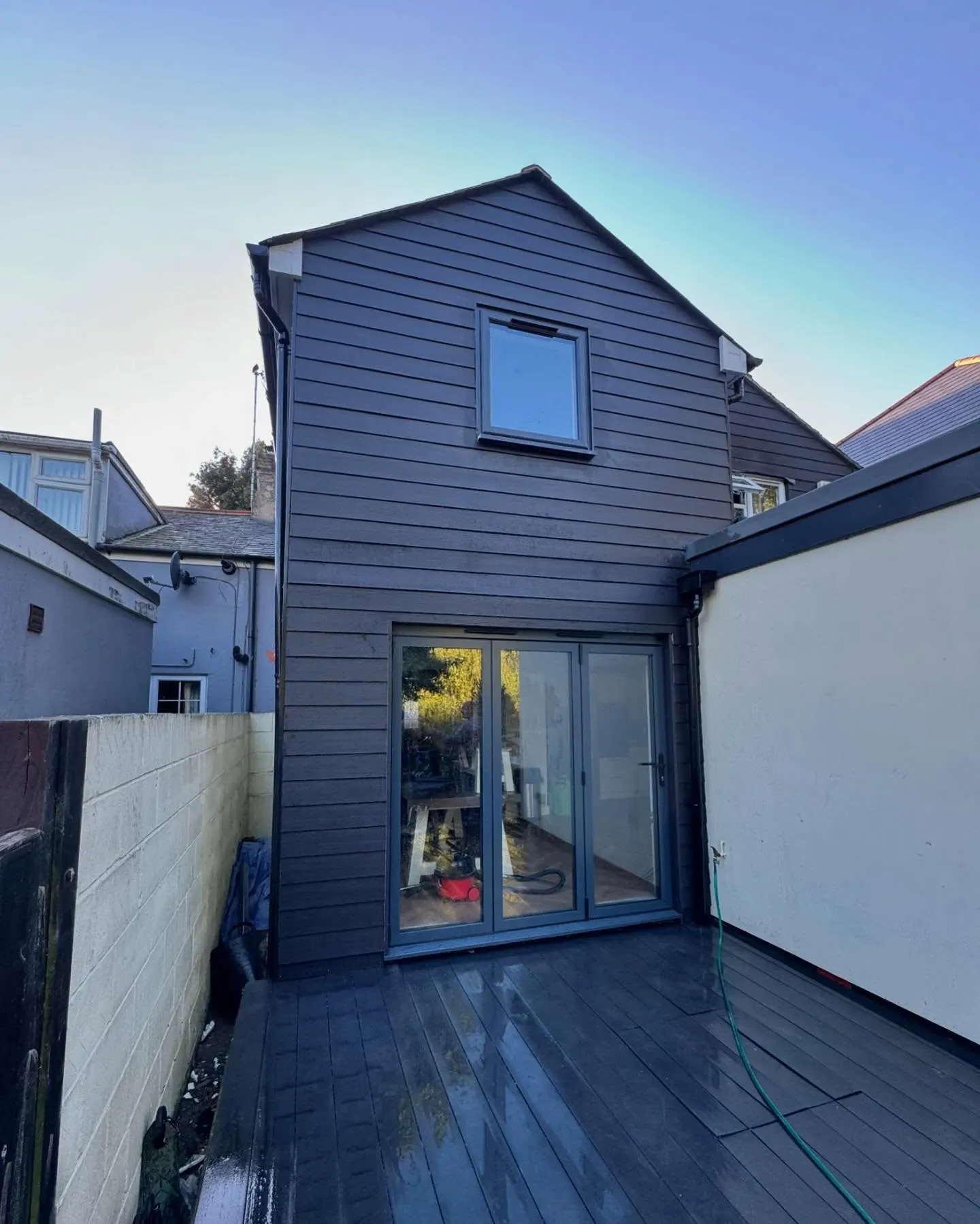
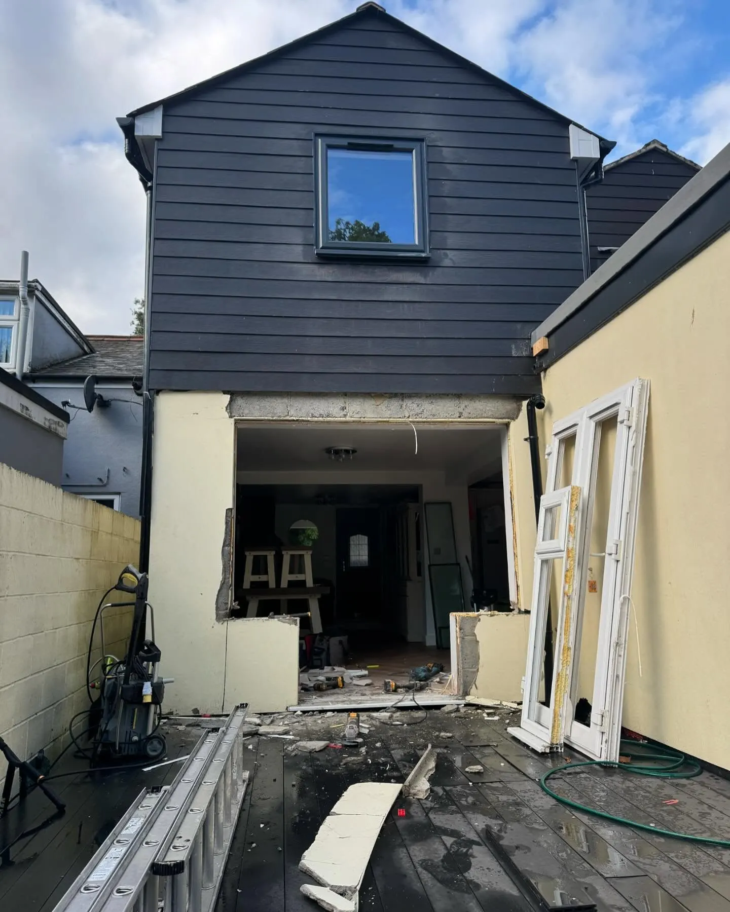
The same wall, before and after.
A two storey rear addition on a job in the Colchester area, photographed as it went. Drag to reveal.
 During
Finished
During
Finished