
Extensions in Thorpe-le-Soken
A ridge-top village designated twice in two separate places, where the first job on any address is working out which boundary it stands in.
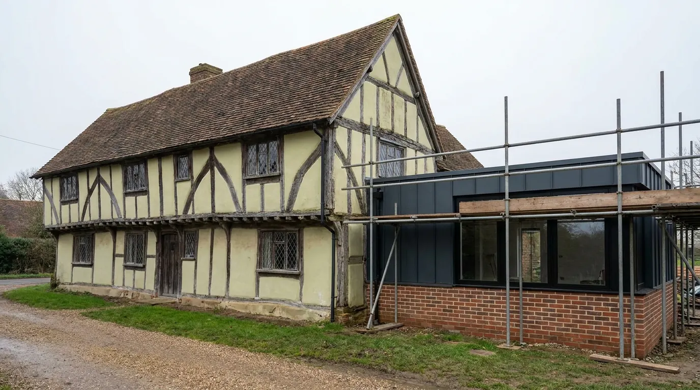 Fig. 01
Extending in Thorpe-le-Soken
A village with two separate conservation areas, a registered park and a High Street where the buildings start at the pavement edge.
Thorpe sits on a ridge of higher ground between Hamford Water and the Holland Brook, on the staggered crossroads where the road from Colchester to the Kirbys and Frinton meets the road between Harwich and the Clacton area. The parish church has Saxon origins, the High Street is lined with older buildings both vernacular and polite, and the village has been a place people stopped at for a very long time.
It is also unusual in this district for having its heritage designated twice, in two places, for two different reasons. That is the fact that decides most Thorpe extensions, and it catches people out because the second designation is nowhere near the first.
Two conservation areas, a mile apart
One covers the village. The other covers a railway station and a derelict maltings, and it is on the national at-risk register.
Applications go to Tendring District Council, which classes Thorpe-le-Soken as one of seven Rural Service Centres in the adopted local plan. The heritage position runs as follows.
The Thorpe-le-Soken Conservation Area was designated on 2 October 1969 and extended on 21 November 1988. It follows the village as a linear settlement along the ridge: the High Street and its long back curtilages, Mill Lane, the churchyard and the woodland fronting Station Road, the grounds of Comarques at the north western end, the crossroads and part of Landermere Road, the Frinton Road frontage, and the registered parkland of Thorpe Hall to the south east.
The Thorpe-le-Soken Station and Maltings Conservation Area is a separate designation made on 26 March 1990, around the station roughly a kilometre south of the village. Its subject is the maltings, a Grade II listed building put up by Robert Free between 1874 and 1878, three storeys with a semi-basement and loft over thirty bays, yellow brick with red dressings under slate. It has stood empty for years, and Historic England records the conservation area as being in very bad condition with a deteriorating trend.
The practical consequence is simple and easy to miss. A house near the station can be inside a conservation area while being a fifteen minute walk from the village that the word “Thorpe” makes people picture. The designation is checked against the address, never against the impression.
What the designation actually removes
Inside either boundary the property is article 2(3) land, and a specific and predictable set of rights disappears.
Class A loses the side extension, the two storey rear extension and cladding. Class B, which governs enlargement of the roof, does not apply on this land at all, so a rear dormer is a full application rather than a certificate. Class E outbuildings are limited to the ground behind the house rather than to the side of it.
Rooflights are where both optimism and pessimism go wrong. They sit in Class C, which carries no exclusion on designated land, so a rooflight within 150mm of the plane of the original slope and no higher than the highest part of that roof stays permitted development on a conservation area house, front slope included, unless an Article 4 direction removes it. Side-facing roof windows must be obscure glazed and non-opening below 1.7 metres, and that condition applies everywhere and not only here. Our page on conservation areas and extensions covers how the applications get assembled.

No Article 4 direction is recorded over the village in connection with extensions, and it costs nothing to have the council confirm the position against your address before anything is relied on.
Thorpe Hall, and why the parkland matters to a house next to it
The registered park is a designation in its own right, and its effect reaches beyond its own boundary.
Thorpe Hall’s grounds are a Grade II Registered Park and Garden, and the conservation area boundary runs around the registered parkland along Station Road and back up Hall Lane. Registration does not add a separate consent regime the way listing does. What it does is make the significance of the park, and the effect of development on its setting, a material consideration the council has to weigh.
For a house on the parkland edge that turns a routine rear extension into a design conversation about height, roof form and what can be seen from inside the park. It is not a refusal in waiting. It is a reason to have the conversation before the drawings are fixed rather than after the first consultation response.
The High Street is a timber frame in disguise
Most of the older village is a frame recast in brick or render, and that changes what you can do to it.
The predominant type on the High Street is the individual house, detached or physically attached to its neighbour, rising straight from the back of the pavement with the roof pitched parallel to the road. Materials are plain clay tile or grey slate over red brick or painted render, with vertically sliding sashes, often small paned, and the occasional dark stained weatherboarded gable turned to the street. Behind those frontages the plots run a long way back, which is where the room for an extension is.
The structure is the part that surprises people. These buildings are usually timber framed, later faced in brick or roughcast, and a frame does not behave like a masonry wall. There is no cavity. There is frequently no wall plate that a steel can simply bear on, which means padstones have to be designed into something that exists rather than assumed. The building moves seasonally, the walls were built to let moisture out, and a new impermeable junction against an old frame traps water where nobody can see it. Sealing an old building up is the commonest way to damage one.
Where the property is listed, a second regime applies. Listed building consent covers the interior as well as the outside, and unauthorised work is a criminal offence rather than a planning breach. What listing does not do is remove the permitted development rights that govern extensions and roof work. Those rights survive; a conservation area designation is what restricts them, and the two things frequently sit on the same building. Our page on listed buildings and extensions sets the two consents side by side.
The New Town that was never finished
A grid of streets was laid out north east of the High Street in the early twentieth century, and only part of it was ever built.
Confidence after the railway produced a proposal to expand the village on a street grid, with New Town Road as its spine. Only fragments were implemented, as parallel roads off Landermere Road, and New Town Road itself is still an unmade lane with an inconsequential junction onto the High Street. Later and more piecemeal development filled the south east side of Landermere Road, a ribbon of housing runs along the Frinton Road to the east, and the twentieth century pushed the village steadily south towards the station.

That history gives Thorpe a housing stock in two distinct halves. There is the pre-1800 village, and there is a scatter of interwar, post-war and later housing on ordinary plots with drives, side access and gardens that take a rear extension without argument. The second half is where most of the building work happens, and it is a straightforward proposition apart from the designation question.
Unmade roads bring one item of their own. Where a road has never been adopted, responsibility for its surface sits with the frontagers, and a wagon delivering blocks to a plot on a private lane is a conversation with the neighbours before it is a delivery. It is worth having early.
The crossroads, and getting materials to the back of the house
Two B roads cross in the middle of the village, and one of them carries the coast traffic in summer.
The road along the ridge and the road crossing it meet at a staggered junction in the centre, and holiday season traffic through Thorpe is heavy enough that the council’s own appraisal calls it out as a negative effect on the character of the place. For a building job that is a timing question. Deliveries planned for the middle of a July afternoon on the main road through the village are deliveries that will stand in a queue.
The frontages compound it. High Street buildings sit on the back of the pavement with no forecourt, so there is nowhere to put a skip except the highway under a permit, and material generally goes through the house or round a long back curtilage on a barrow. On the twentieth century stock away from the centre none of that applies and the logistics are ordinary.
Clay on a ridge, old trees and what is under the garden
Three separate things can move a foundation here, and only one of them shows on a map.
The village sits on London Clay along the ridge, with the usual variable cover of later sands and gravels, so the depth a foundation has to reach is not a constant across the parish. A trial hole answers it properly, and our guide to extension foundations covers what that depth then costs.
Mature trees are the second. Comarques has extensive mature grounds, the churchyard and the burial ground are heavily treed, there is woodland fronting Station Road, and the Hall has its parkland. Large trees on shrinkable clay pull the foundation depth down a long way, and inside a conservation area any significant tree work needs six weeks’ written notice to the council before it starts, whether or not a Tree Preservation Order exists. Our guide to Essex clay, shrinkage and heave explains why felling the tree is rarely the shortcut it looks like.
Archaeology is the third. Worked flints of Palaeolithic date have been recorded at two sites near the village, and cropmarks probably of Bronze Age or Iron Age date occur at Thorpe Green and around the Hall. The county historic environment record holds what is known, and the council will indicate whether an archaeological condition is likely on a given address. On a domestic extension that normally means a watching brief rather than an excavation, and knowing in advance costs almost nothing against finding out with a digger standing idle.
What people build here
The village and the estates want different things, and both are common.

On the older High Street properties the work is a rear extension into the long back plot, usually single storey, designed to read as a subordinate addition rather than a continuation of the frontage, and frequently combined with putting right a previous alteration that trapped moisture in a frame. Roof work is a full application rather than a certificate, so it is planned as such from the beginning.
On the twentieth century housing it is the ordinary work: single storey rear extensions to open a kitchen into a living space. After those come loft conversions where the roof was cut rather than trussed, and garage conversions. Matching brick is a recurring question on the later stock and a rarer one in the village, where the honest answer is more often a deliberate contrast than a near miss. Our page on matching brickwork explains why a near miss usually looks worse.
Questions we get asked in Thorpe-le-Soken
Which conservation area am I in?
There are two and they do not touch. One covers the village along the ridge, the other covers the station and the maltings to the south. A property can be in either, or in neither, and it is checked against the address.
My house is listed. Have I lost permitted development?
No. Listing adds a second consent that reaches inside the building, and unauthorised work under it is a criminal matter. It does not take away the rights that govern extensions and roof work. A conservation area designation is what restricts those, and many buildings here have both.
Can I put a dormer on the back?
Inside either conservation area, not without permission, because roof enlargement is excluded on that land. Rooflights in the plane of the slope are the exception and stay permitted. Outside the boundaries the ordinary allowances apply.
Do I need an archaeological survey?
Usually not for a domestic extension, and where something is required it is normally a watching brief while the trench is dug. The council indicates it at application stage rather than springing it later.
Getting a price for a Thorpe-le-Soken extension
We are based at West Bergholt on the far side of Colchester, and Thorpe is the point everything on this side of the district passes through on its way out to Kirby Cross and the coast.
Our team comes out and works through what decides the number here: which of the two conservation areas your address is in or whether it is in neither, whether the building has a frame behind the render, how material is going to reach the back of the plot, what the trees within influencing distance are doing to the foundation depth, and what a trial hole finds. Most people who call us already have drawings and permission and want a builder to price the work and build it. That is the ordinary job here, and we are glad to work to somebody else’s plans. Where the drawings do not exist yet, we bring in the technician who draws it and the structural engineer who calculates it, we handle the application with Tendring District Council where one is needed, we notify Building Control, and we run the job as main contractor.
We carry £2m public liability cover and build to current Building Regulations, through to the completion certificate. The survey and the quotation cost nothing.
Last reviewed August 2026.
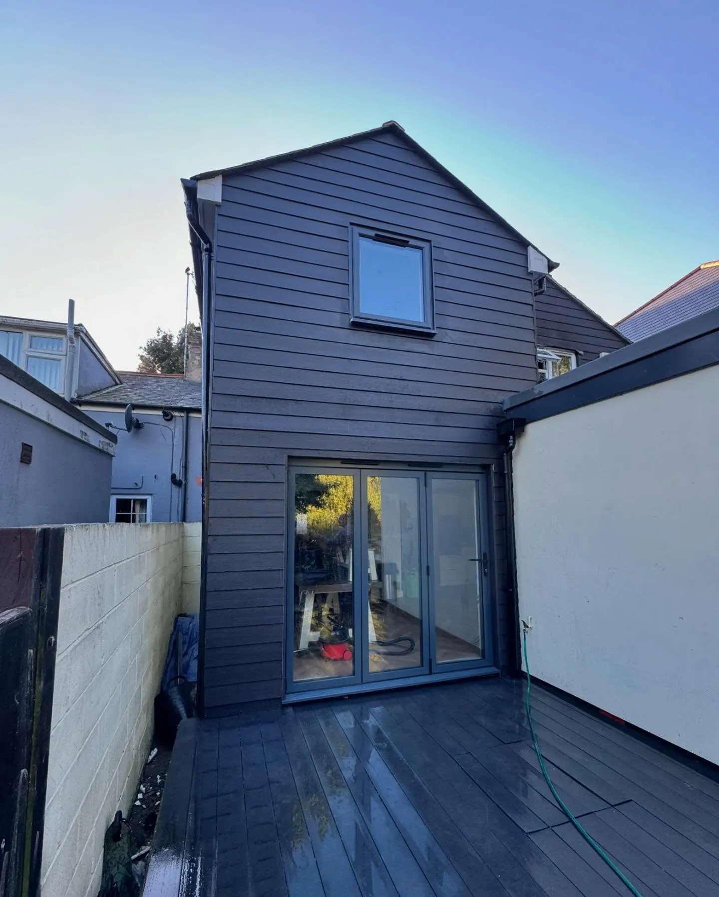
The same wall, before and after.
A two storey rear addition on a job in the Colchester area, photographed as it went. Drag to reveal.
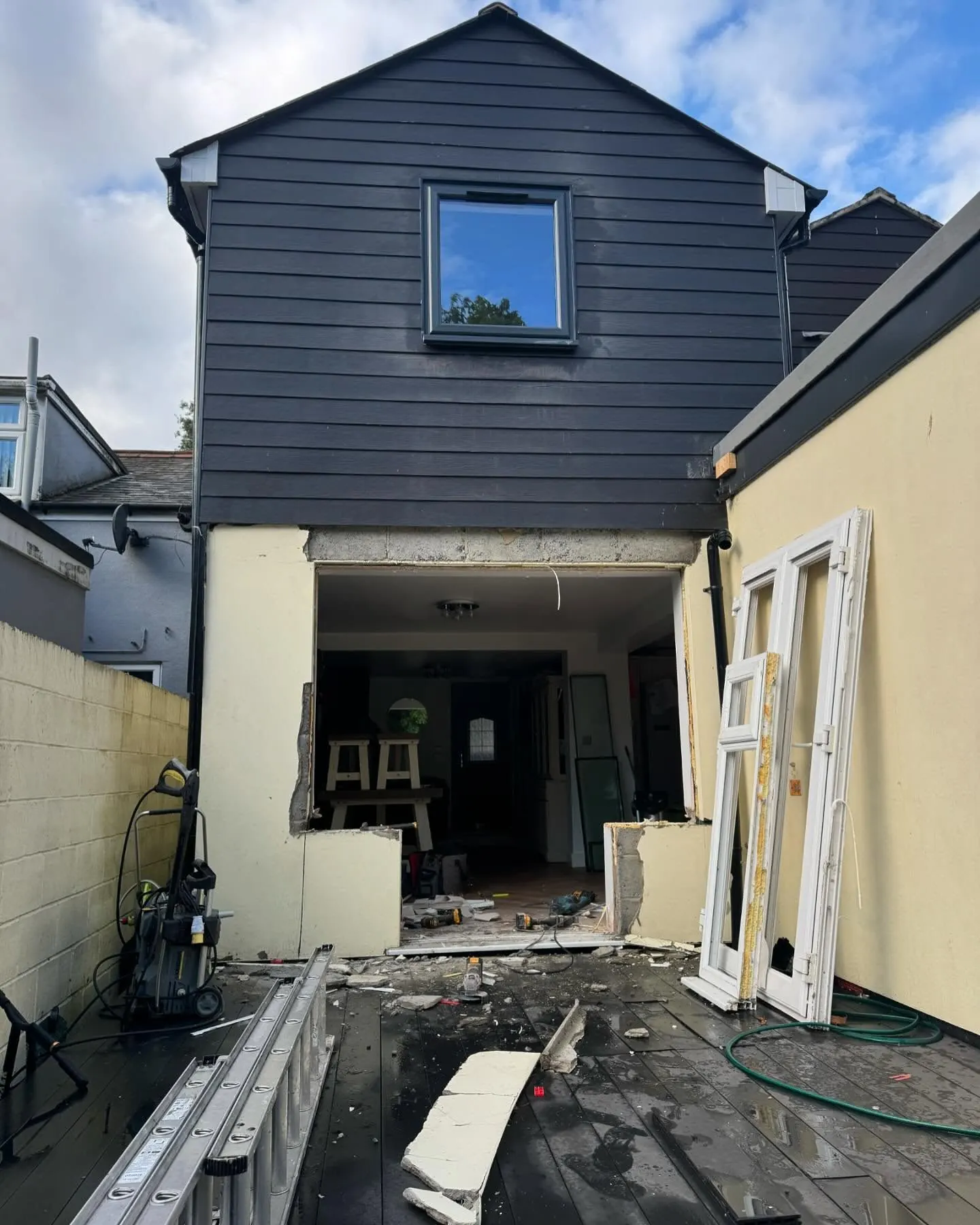 During
Finished
During
Finished