
Extensions in Stratford St Mary
The village on this list with no designated line to look for, where the boundary that decides your foundation runs through the back garden instead.
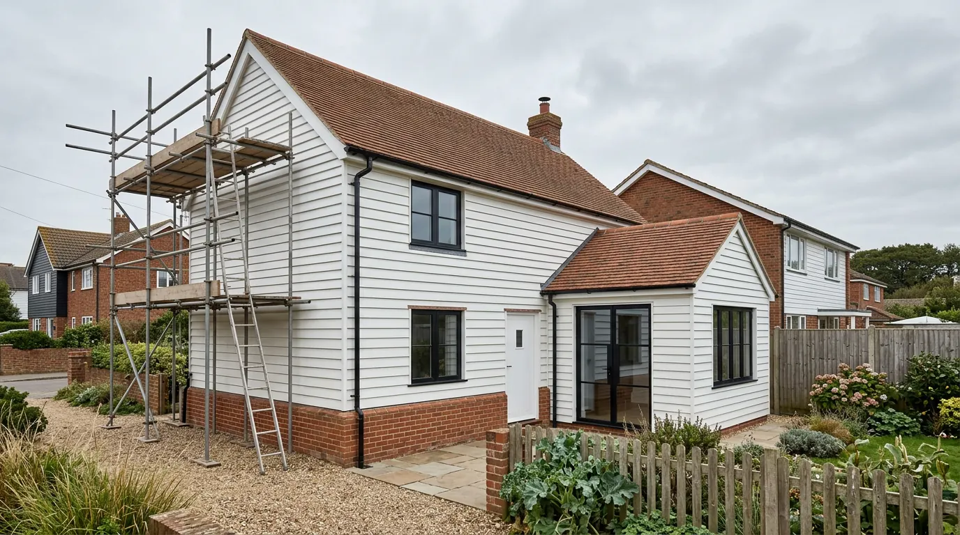 Fig. 01
Extending in Stratford St Mary
A street a good kilometre long, laid between a dual carriageway and a floodplain, with the landscape designation over all of it and the ground changing halfway down the garden.
Stratford St Mary stands on the Suffolk bank of the Stour, where the old London to Yarmouth coast road crossed into Essex. The 2011 census counted 701 people. It is essentially one thoroughfare: Lower Street coming up from the bridge and turning into Upper Street at the bend by the pumping station, with newer housing in closes behind.
Two lines govern most of what happens on a building site here, and neither is a planning boundary. One is the A12, which took the traffic off the street and left the church stranded on the far side of it. The other is the edge of the river terrace the street is built on, where the back gardens on the river side stop being gravel and start being floodplain.
Who decides
Babergh District Council, in Suffolk, whatever the address on your post says.
Stratford St Mary is a civil parish in the Babergh district, so an application is determined by Babergh District Council, with the parish council as a consultee. It is worth spelling out, because this is the last village before the border and daily life points the other way: the postcode is a Colchester one, the town and the station are in Essex, and Dedham is a field and a river away under Colchester City Council. The boundary is the water itself. Highways sit with Suffolk County Council, so a skip on the road or an altered access runs to its own timetable.
The geography carries a design consequence as well. A house near the bottom of the village is read from the Essex bank and from the riverside footpath, so a drawing prepared only for the view from the street has left out half its audience.
There is no designated line to find here
Every address in the parish is inside the Dedham Vale National Landscape, so the rights it removes are removed from all of them.
Dedham Vale was designated an Area of Outstanding Natural Beauty in 1970 and renamed a National Landscape in November 2023, a change of label rather than of law, which is why planning documents still say AONB. In most villages along this valley the first job is working out which side of a mapped line an address falls on. That step is short here, as it is at Higham upstream. Along the A12 at Capel St Mary the step does not arise at all, because no National Landscape covers the housing there and no conservation area covers the estates. The designation takes in the whole parish, coming closest to leaving it only at the top corner out in the fields, and it clips none of the housing. A 1970s house in a close behind Upper Street is on designated land exactly as the timber frame on the street in front of it is.
Land inside it is what the permitted development order calls article 2(3) land, and the consequence is a checkable list rather than a general atmosphere. Under Class A, which governs extensions, a side extension is not permitted development at any width, a rear extension of more than one storey is excluded, cladding the outside of the house is excluded, and the larger home extension prior approval route under paragraph A.4 is unavailable. Class B, covering roof enlargements and therefore dormers, does not apply either. What survives is Class C: a rooflight within the plane of the existing slope, no more than 150mm beyond the plane of the original roof and no higher than its highest part, obscure glazed where it faces a side elevation. Our guide to permitted development rights takes the classes in order.
The conservation area, and a map worth distrusting
Drawn in 1971, revised in 1973, and the version published on the national planning map is not the one that governs your house.
East Suffolk County Council designated the Stratford St Mary conservation area in 1971 and revised it in 1973. Babergh inherited it when the district was created in 1974, and the appraisal describing it was adopted as supplementary planning guidance on 6 March 2008.
The boundary is where care is needed. The mapped extent held in the national planning dataset covers well under a hectare at the bottom of the village, which is plainly not the designation the appraisal draws, and the record itself notes that the best map is the plan inside that document. A digital boundary that disagrees with the paper it points back to is not something to design against. It gets confirmed with Babergh against the address instead, which costs nothing.
What it adds is control over demolition, six weeks’ notice before work to trees above the size threshold, and an officer assessing materials and detailing rather than bulk alone. Our conservation area guide covers the mechanism. Trees deserve a line of their own here, because the appraisal records preservation orders on the ash on the green, on ash behind the former King’s Arms, on beeches, limes and horse chestnuts and over the grounds of The Kennels, and none of them appears on the national dataset. An empty map is not a clearance. No Article 4 direction is recorded over the village either, and the council will confirm that against your address for nothing.

The road that left, and the church it kept
The dual carriageway crosses the river fifty metres from the foot of the street and takes a Grade I church with it.
The Ipswich turnpike ran down this street and met its Essex counterpart at a toll house by a bridge upstream of the present crossing, which is where the Talbooth gets its name. A cast iron milepost still standing in Lower Street counts eleven miles to Ipswich and seven to Colchester, which tells you what the street was for.
Its replacement cut the parish in half. The church of St Mary, the one genuinely exceptional building here, now stands on the far side of the carriageway from the village it serves, reached by an underpass, and the road is breached in only two places: at the bottom of the village by the river crossing, and at that underpass.
Two things follow for a build. Access is the easy half. The street is quiet now, which makes it one of the better village frontages in this area to work on, though a skip on the highway still needs the county’s permit, and anything on the church side has one vehicle route in. Noise is the other half. A new room on the eastern edge of the village sits closer to a national speed limit dual carriageway than the original house does, which is a specification question before it is a planning one: glazing gets chosen for what it stops as well as what it lets in, and the ventilation has to work with the windows shut, because on that elevation people keep them shut.
What the street is built of
Rendered frames under steep plaintile roofs, later brick fronts hiding older timber, and twentieth century closes behind the whole lot.
Thirty-four entries in the parish are listed: the church at Grade I, two at Grade II*, and the rest at Grade II, a good many of them listed in February 1955. Three are inns or former inns, the King’s Arms at the bend with the Swan and the Black Horse below it. A coaching village leaves behind a particular sort of building, wide fronted and deep in plan, where the useful work is very often internal rather than an addition on the back.
Older buildings here are mostly timber frames finished in render and colourwash under steep plaintile, and that steepness is a useful diagnostic. A brick fronted house under a sharp plaintile pitch usually has a frame behind the brick, because the pitch belongs to the original roof and the front is a later skin. What is on the outside is weak evidence of what turns up when a wall is opened. Later buildings are brick under slate, predominantly the soft local Suffolk red, some of it since painted or rendered.
Most enquiries, though, come from the housing behind the frontage. Matthews Close, Tenter Field, Drum Field, Strickmere, Spanbies Road and Veyses End are conventional masonry, cavity walled, with trussed rafter roofs on the later ones and gardens that take a rear extension without argument. The designation lands on them identically.
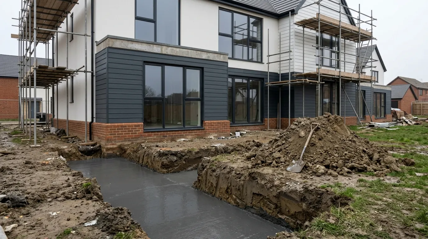
One garden, two different grounds
The street is built on river terrace gravel and the plots on the river side run off it onto floodplain alluvium, and the change happens inside the garden.
The geological mapping puts the strip carrying the street on river terrace deposits, sand and gravel laid down when the Stour flowed higher than it does now. West of that the terrace stops and alluvium takes over, the clay and silt the river dropped on its floodplain. On the western side of Lower Street that switch happens tens of metres behind the front wall, which is to say within the back gardens.
The two behave nothing alike. Gravel gives bearing at a sensible depth, but a trench cut in it will not stand on its own and groundwater has to be managed while concrete is placed. Alluvium may offer no useful bearing near the surface at all: it is soft, compressible and variable over short distances, and the answer there is often not a deeper trench but a different foundation altogether, designed by calculation. A rear extension running back from a Lower Street house can begin on one and finish on the other, and a foundation designed for the front half of it is not a foundation.
Away from the street it changes again. On the rising ground to the north the terrace runs out and the Thames Group clay, usually called London Clay, reaches the surface, which brings back the familiar conversation about seasonal shrinkage and any mature tree within influencing distance. Depth and type are settled by a trial hole on your plot rather than by a postcode. Our guide to extension foundations goes through the types and what each one solves.

Where the flood zones fall
Flood Zone 3 reaches the back of the plots on the river side of Lower Street, and Upper Street sits clear of both zones.
The Environment Agency’s flood map for planning places the meadows west of Lower Street in Flood Zone 3, the highest risk band, and it comes up to the rear of the gardens on that side. Flood Zone 2 crosses the street itself in places lower down and stops short of the top of the village, so an Upper Street address is generally outside both.
A householder extension counts as minor development here, so the sequential test does not stand in the way of an application, and the response lives in how the thing is built: floor level set deliberately rather than inherited, a solid floor, services lifted, and materials in the bottom half metre specified because they will dry out. Our guide to flood zones and extensions explains how the levels get established.
What people build in Stratford St Mary
Work at the back, rooflights instead of dormers, and a good deal of reordering inside old buildings.
Single storey rear extensions lead. On the twentieth century housing they are the one move still capable of being permitted development, and on the historic frontages the back of the house is where change reads least from the street.
Roof work is second and nearly all of it is rooflight conversions. On a steep plaintile slope over a frame, that tends to be the right answer regardless, since a box dormer rarely improves a roof of that pitch and here it also costs an application. Garage conversions follow, suiting the closes because the work is largely internal. Side extensions and two storey rear additions have not stopped happening; they simply begin with an application, and they are won on roof form, ridge height and what the new elevation is finished in.
Questions we get asked in Stratford St Mary
Which council is it, given the Colchester address?
Babergh District Council. The county boundary is the river and the village stands on the Suffolk bank, so the postal address and the planning authority are two different things. What costs people time is the validation list and the building control service, neither of which is Colchester’s.
Is my house in the conservation area?
Possibly, and the national map is not the place to settle it. The digitised boundary published for this village covers a fraction of what the designation plan shows, and the record points back to the appraisal’s own map. Babergh will confirm it against your address.
Why did a house down the street need a designed foundation when the one opposite did not?
Most likely the terrace edge. The street sits on gravel and the ground drops onto floodplain alluvium behind the plots on the river side. It is settled by opening a hole on your own plot rather than by comparing quotations with a neighbour.
Does being near the A12 change the specification?
It changes the glazing and how the room is ventilated. A new space facing a trunk road has to work with the windows closed as well as open, and that is decided on the drawings rather than discovered after the plaster is on.
Getting a price for a Stratford St Mary extension
We are at West Bergholt, round the other side of the valley, so coming out to stand on the plot is straightforward rather than a special trip.
Our team looks at the house and the ground together: what is behind the render, how far back the gravel runs before the material changes, where the floor level sits relative to the meadow, and what the conservation area plan actually shows for your address. Most people who call us already have drawings and permission and want a builder to price the work and build it. That is the ordinary job here, and we are glad to work to somebody else’s plans. Where the drawings do not exist yet, we bring in the technician who draws it and the structural engineer who calculates it, we handle the application with Babergh District Council and any listed building consent alongside it, we notify Building Control, and we run the job as main contractor.
We carry £2m public liability cover and build to current Building Regulations, through to the completion certificate. The survey and the quotation cost nothing.
Last reviewed August 2026.
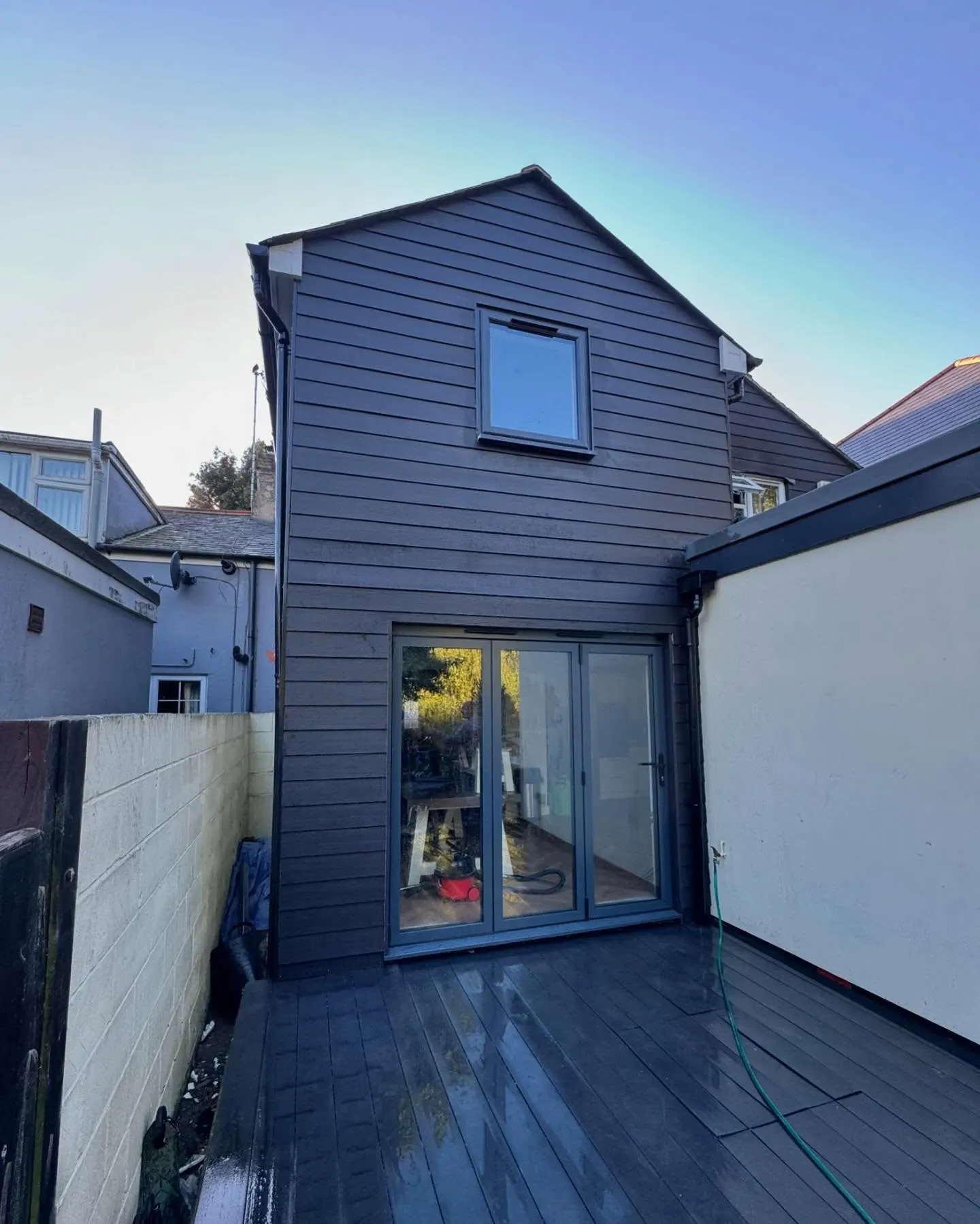
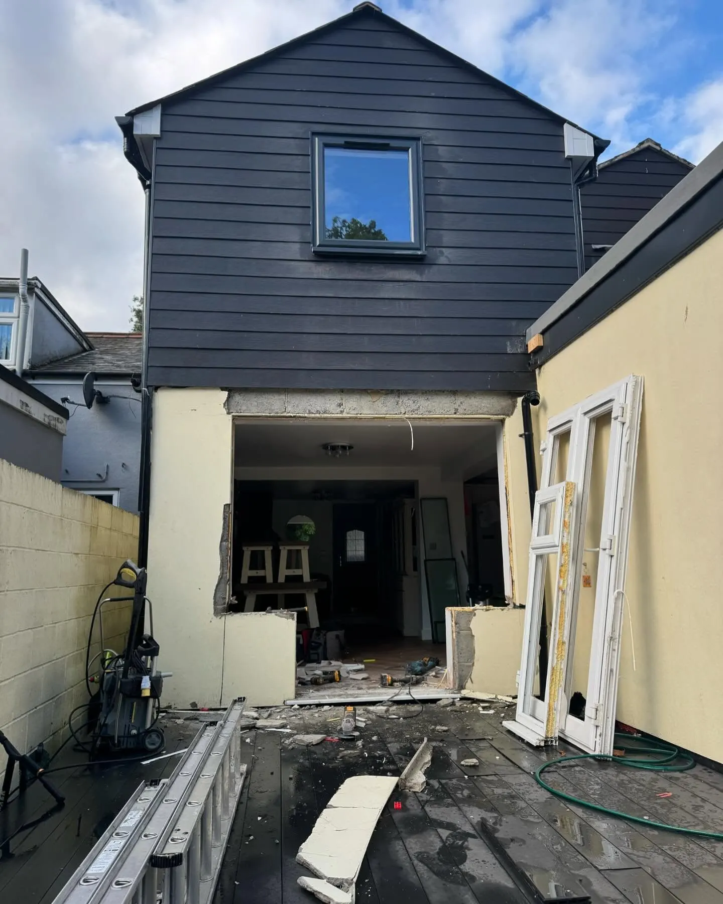
The same wall, before and after.
A two storey rear addition on a job in the Colchester area, photographed as it went. Drag to reveal.
 During
Finished
During
Finished