
Extensions in Heybridge
A parish of eight thousand people where the designation follows a canal, the water table follows the winter, and the fence sets the roof height.
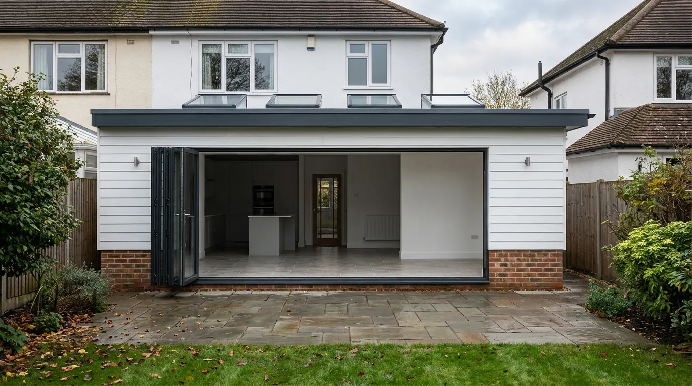 Fig. 01
Extending in Heybridge
Eight thousand people, an ironworks that ran for the best part of two centuries, and a conservation area that follows a canal instead of a street.
Heybridge is not a village, whatever the address implies. At the 2021 census the parish held 8,312 people, which makes it larger than most Essex towns that call themselves one, and it runs into Maldon across the Fullbridge with nothing but a river to mark the join. The last stretch of the Chelmer and Blackwater Navigation comes through it from Beeleigh and finishes at Heybridge Basin, which since 2020 has been a separate civil parish of its own with fewer than six hundred residents. The two names get used interchangeably and they are not the same place.
Maldon District Council is the planning authority, from the offices on Princes Road across the river. Building work here is decided by the district, not by the town, and not by Chelmsford or Colchester whatever the postal address suggests.
The designation follows the water
Most conservation areas cover a historic core. The ones here run in a ribbon along a canal, which means the line can pass down the bottom of your garden.
Two designations sit over this parish and both of them are about the Navigation. Heybridge Basin was designated on 21 January 1975 and holds a small group of listed buildings around the sea lock, where the canal meets the tidal estuary. The Chelmer and Blackwater Navigation itself was designated on 20 November 1991 as a linear conservation area, following the water and its banks rather than a settlement.
A ribbon designation behaves differently from a village one. In a village you are broadly in or broadly out and your neighbours are in the same position. Along a canal corridor, one row of houses can back onto designated land while the row behind it is untouched, and the boundary can run through the end of a garden rather than around a block. It follows that a Heybridge answer is genuinely address-specific. Most of the twentieth century housing in this parish sits well away from either designation, but the only way to know which side of a line you are on is to have the council confirm the current mapping. No Article 4 direction is recorded over the settlement, and that is worth asking about at the same time.
One nuance that catches people out. Being just outside a conservation area does not make it irrelevant. A proposal that sits outside the boundary but is clearly seen from within it can still be assessed for its effect on the character and appearance of the area, because that is a material consideration in the decision. What being outside does give you is your permitted development rights back, which is the substantial part.
What Bentall’s left in the ground
Heavy engineering ran on this site for the best part of 180 years, and it did not take its ground conditions with it when it closed.
Bentall’s built agricultural machinery at Heybridge for the best part of 180 years, closing in 1984, employing six or seven hundred people by 1914 and briefly making motor cars before the First World War. Ironworking on that scale over that long leaves a footprint: yards, bases, tracks, ash and clinker fill, and buried slabs.

Two things follow for a householder on or near former works land. The first is planning. Where a site has a history of industrial use, an application can attract a condition requiring a desk study, and where that raises anything, a site investigation and a remediation strategy to be agreed before work starts. That is a discharge of condition on its own timescale, and it is far cheaper to anticipate than to meet halfway through a programme.
The second is the trench. Made ground is fill: it was placed rather than laid down under pressure, its depth varies across a few metres, and it will not carry a foundation load predictably. Where it is present the answer is usually to found through it onto competent material beneath, which means depth, and depth means money. Buried obstructions are the other half of it, because a machine base from 1930 does not appear on any drawing anybody still holds and it is discovered by a digger bucket. Our page on extension groundworks covers what happens once the ground is open.
The same history runs deeper. When the estates on the northern side were built in the mid 1990s, the excavation was preceded by full archaeological work that found Iron Age, Roman and Saxon occupation. On a normal rear extension that is not a live issue. On extensive groundworks, or on a plot the council’s archaeological advisers flag, the usual outcome is a condition requiring a watching brief during excavation rather than a refusal.
Flat ground, and water in the hole
The practical difference between building here and building on the hill at Maldon is how quickly the trench fills.
Heybridge is flat. The land between the Navigation, the creek and the estuary sits low and the water table can be close to the surface for much of the winter, and that changes groundwork from a scheduling task into a technical one.
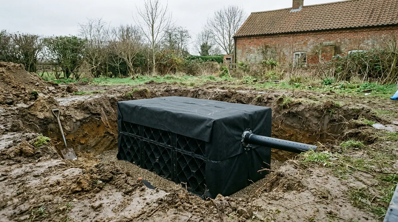
Concrete cannot be placed into standing water. A trench that has taken water has to be pumped clear and kept clear while the pour goes in, and on some plots here that means a pump running for the duration rather than a bucket at the start. Saturated ground is also less stable, so a trench that would stand up unsupported in dry clay may need battering back or supporting, which takes more room in a garden that has none to spare. And a foundation trench left open overnight in wet ground is not the same trench in the morning: the sequence gets planned so that digging, inspecting and pouring happen close together rather than across a week.
Surface water is the other consequence, and it separates this parish from the gravel strip running north east towards Goldhanger, where a soakaway can genuinely work. Here a soakaway needs ground that will take water away, and low ground with a winter water table near the surface frequently will not, so run off from a new roof and a new patio has to go to a sewer or a watercourse by a designed route rather than into a hole in the lawn.
The low ground along the Navigation, the creek and the Basin also sits in the higher flood zones. Where it applies, householder development is exempt from the sequential test and what is needed is a proportionate flood risk assessment setting the finished floor level, as our guide to flood zones and extensions in Essex explains. The boundary of those zones is checked against the property, not against the parish.
The housing stock, and the boundary that governs it
This is estate country, and on an estate plot the limiting factor is almost never the garden. It is the fence.
Heybridge has stock from most of the last century and a half: Victorian and Edwardian housing around the old core and the works, interwar and post-war building, private estates from the 1960s through the 1980s, a substantial wave in the mid 1990s, and continuing growth on the northern edge since. Roofs from the 1960s onward are trussed rather than cut, walls are cavity, and garages are attached or integral.
What distinguishes the later estates is plot geometry. Houses sit close to their side boundaries, gardens are shorter than they look, and the space you are actually working with is the gap between the flank wall and the fence. Two rules do most of the deciding.
- Eaves height near a boundary. Under Class A, where any part of a single storey extension comes within two metres of the boundary, the eaves height must not exceed three metres. On a tight estate plot that is the rule that sets your roof, and it is why so many extensions here are flat roofed or have a very shallow mono pitch rather than a matching gable.
- Excavation near the neighbour. Digging within three metres of an adjoining structure to a depth below its foundations triggers a notice under the Party Wall etc. Act 1996, and on a close-set estate that is nearly every rear extension on a flank boundary. Notice periods are fixed in law and run from service, so this is started early or it delays the start. Our guide to the Party Wall Act covers which section applies.
How close you can build, and what changes at each distance, is set out in our answer on how close to the boundary you can build.
What people build here
Practical work on practical houses, and a lot of it done under permitted development.
The commonest job is a single storey rear extension to make a kitchen and dining space out of two small rooms, usually with a flat or shallow roof because of the eaves rule above. Side infill comes second, where there is a gap between the house and the boundary wide enough to be worth roofing over.
Loft conversions are the awkward one. A trussed rafter roof is a designed structure that carries the roof load through the whole web of timbers, so a loft in a 1970s or 1980s house is not a matter of boarding it out: the trusses have to be replaced by a structure that carries the same loads with the middle taken out, which is a steel and timber job with an engineer’s calculations behind it. It is entirely doable. It is not the cheap option people assume, and being told that at the survey rather than in week three is the difference between a plan and a disappointment.
Because so much of the parish sits away from the designated corridor, permitted development is often genuinely available here. Where a job relies on it, a lawful development certificate is the document that answers the question when the house is sold, and it is worth having at the time rather than hunting for evidence years later.

Questions we get asked in Heybridge
Our garden backs onto the canal. Are we in a conservation area?
Possibly. The Navigation is designated as a linear conservation area along the water and its banks, so the line can run through the end of a garden. It is confirmed against the address rather than assumed from the view.
Is my plot on the old works site?
It is a fair question anywhere near the old industrial land, and it is answered by a desk study rather than by memory. Where former industrial use is identified, expect a planning condition about it and expect made ground in the trench.
Why is a loft conversion dearer in my house than in my sister’s 1930s semi?
Because your roof is trussed and hers is cut. Removing the middle of a trussed roof means replacing the structure that was doing the work, and that is engineered rather than improvised.
Do we pay a coastal charge for being on the Blackwater?
No. The Essex Coast RAMS tariff applies to net new dwellings. An extension to an existing house sits outside it.
Getting a price for a Heybridge extension
We are based at West Bergholt and work down this side of the district regularly. The town over the river runs on very different ground and a much larger designation, and you can read how in extensions in Maldon.
Our team comes out and looks at the ground, the water table, the site history, the boundary distances, the access for deliveries and the conservation position, then says what the job depends on before saying what it costs. Most people who call us already have drawings and permission and want a builder to price the work and build it. That is the ordinary job here, and we are glad to work to somebody else’s plans. Where the drawings do not exist yet, we bring in the technician who draws it and the structural engineer we work with, we handle the planning route with Maldon District Council, we notify Building Control, and we run the job as main contractor.
We carry £2m public liability cover and build to current Building Regulations, through to the completion certificate. The survey and the quotation cost nothing.
Last reviewed August 2026.
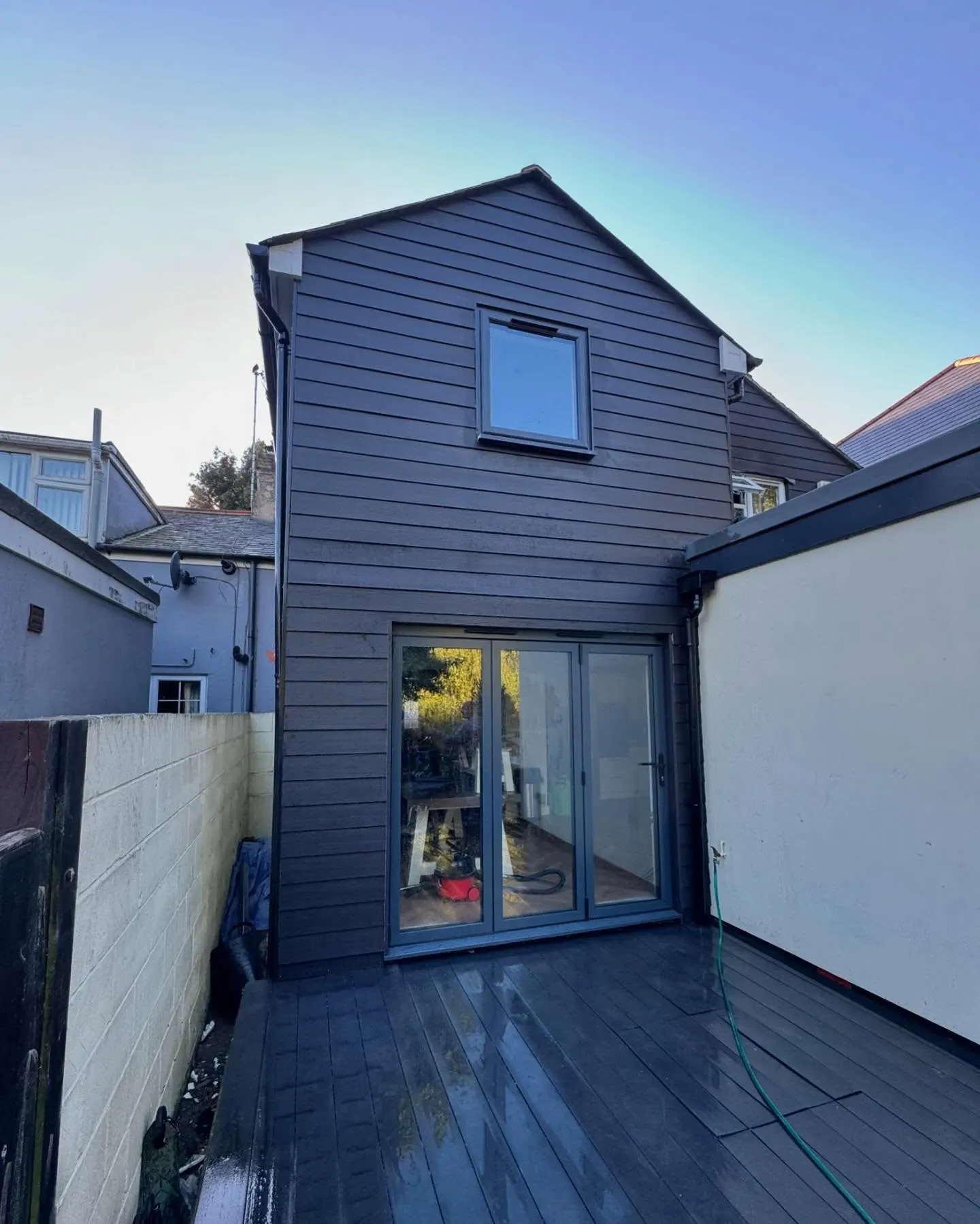
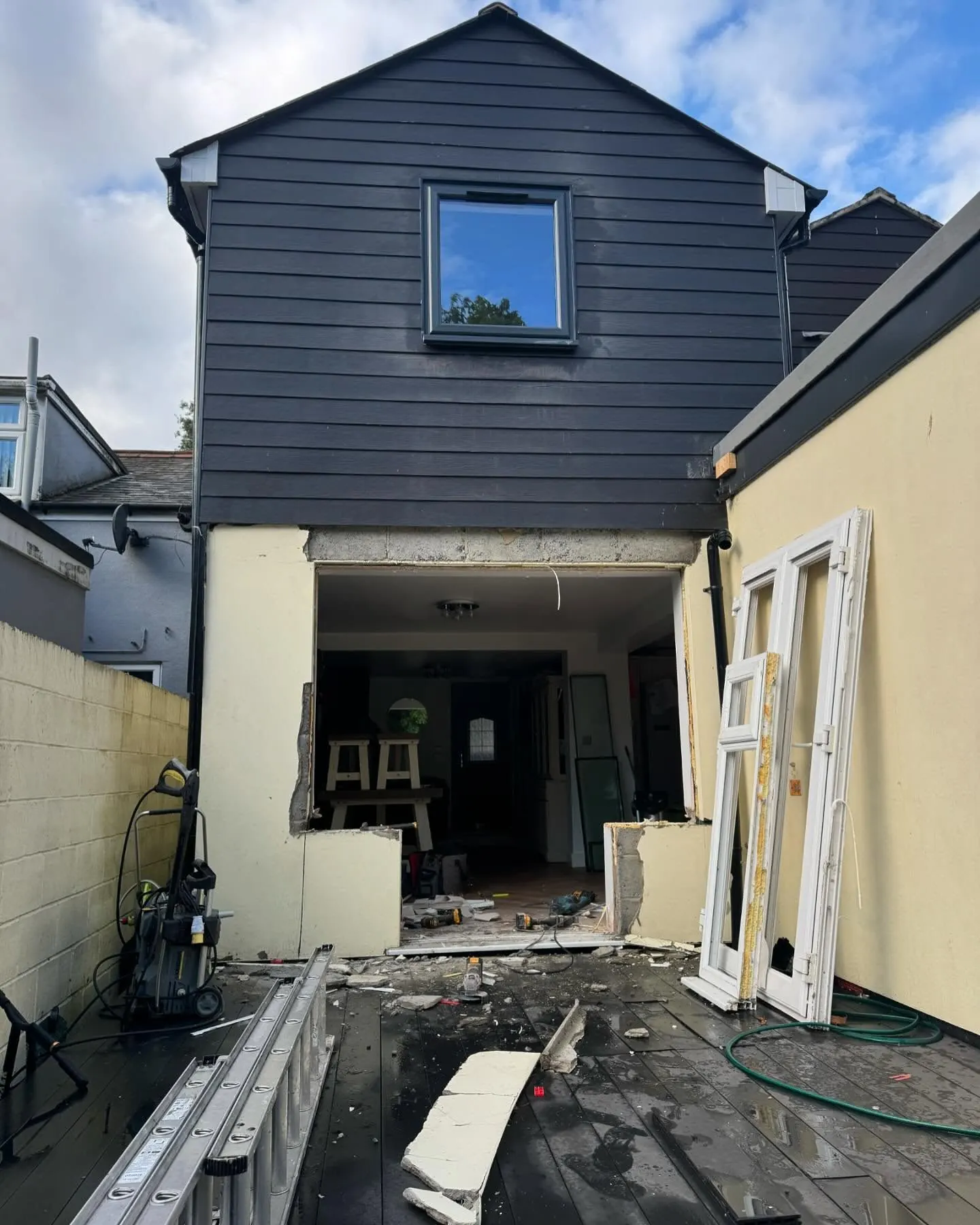
The same wall, before and after.
A two storey rear addition on a job in the Colchester area, photographed as it went. Drag to reveal.
 During
Finished
During
Finished