
Extensions in Bures
The river is the boundary, and which bank the house stands on decides the council, the local plan and the fee.
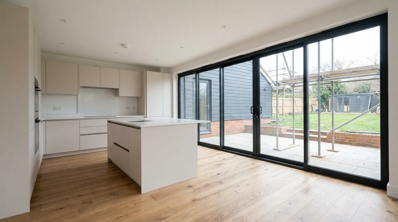 Fig. 01
Extending in Bures
One village, one street, two counties and two councils. The line between them is the river, and which side of it your house stands on decides everything about the paperwork.
Bures looks like a single place and functions like one. It is not one, administratively. The eastern part is Bures St Mary, a civil parish in Suffolk, and its planning applications are decided by Babergh District Council. The western part is Bures Hamlet, a civil parish in Essex, and its applications are decided by Braintree District Council. The River Stour runs between them.
The split is old rather than recent. Bures Hamlet was part of the ancient parish of Bures St Mary until 1866, when the Essex portion became a separate civil parish; the present name was adopted in 1974. Ecclesiastically it never separated at all, which is why Bures Hamlet sits in the Diocese of St Edmundsbury and Ipswich rather than with the rest of Essex, and why almost nobody living here thinks of the two halves as different places.
Planning does. An application submitted to the wrong authority is not forwarded on. It is returned, the fee follows it back, and the weeks are gone. We confirm the authority from the address before anything is drawn.
What actually differs across the bridge
The national rules are identical on both banks. Everything wrapped around them is not.
| Bures St Mary, Suffolk | Bures Hamlet, Essex | |
|---|---|---|
| Planning authority | Babergh District Council | Braintree District Council |
| Adopted development plan | Babergh and Mid Suffolk Joint Local Plan Part 1, adopted November 2023 | Braintree District Local Plan 2033, in force since July 2022 |
| Plan-making underway | A new joint local plan for both Suffolk districts, running to 2045 | A review of the 2033 plan |
| Conservation area | Bures St Mary, designated 19 October 1973 | Bures Hamlet, designated 2 October 1969 |
| Local authority building control | Babergh’s team | Braintree’s team |
| Highways, skips and dropped kerbs | Suffolk County Council | Essex County Council |
The permitted development order is national law and applies identically either side of the water. What changes is who applies judgement to the parts that are not automatic: the design and amenity policies, the validation checklist, the fee schedule, the local list of non-designated heritage assets, and the officer who writes the report. Two neighbours facing each other across the Stour with the same house and the same drawings are working to two different local plans and two different sets of expectations.
It reaches past the application, too. If you use local authority building control rather than a registered building control approver, that is a different team on each bank. A skip on the road or a new dropped kerb goes to a different county council.
Two conservation areas, four years and one river apart
Both halves of the village are designated, by different councils, at different times, under different appraisals.
Braintree designated Bures Hamlet on 2 October 1969. Babergh designated Bures St Mary on 19 October 1973. The two boundaries meet at the water, which produces the unusual situation of a single village street running through two separate conservation areas.
The effect on your rights is the same on both banks, because it comes from the national order rather than from the designation document. Inside either boundary the land is article 2(3) land, and that removes side extensions and rear extensions of more than one storey under Class A, roof enlargement including dormers under Class B, and cladding in render, timber, tile, stone or plastic. It also closes off the deeper single storey rear extension available elsewhere through the prior approval route at paragraph A.4.

What survives is worth knowing precisely. Rooflights sitting in the plane of the existing slope fall under a different class, one that carries no exclusion on designated land, so that right is not removed by the designation, front slope included. The conditions are that they project no more than 150mm beyond the plane of the original slope measured perpendicular to it, sit no higher than the highest part of the original roof, and that any roof window in a side elevation is obscure glazed and non-opening below 1.7 metres. That last condition applies everywhere, not only here. Our conservation areas guide takes the whole split apart.
Work to a tree of any size inside either boundary needs six weeks’ written notice, with or without a preservation order. Notice goes to the council whose area the tree is in.
The listed buildings, and the odds your neighbour is one
Around seventy-five listed buildings stand in the Suffolk parish alone, which changes the arithmetic of a village this size.
With that density, the more useful question is usually not whether your house is listed but whether the one attached to it is. The effect of development on the setting of a listed building is a statutory consideration in its own right, quite separate from the conservation area, and it applies to your application even when nothing on your title is listed.
Where your own house is listed, the position is often misunderstood. Listing does not remove the permitted development rights that govern extensions and roof work. It adds listed building consent as a second regime, running under separate legislation, covering interiors as well as exteriors, and making unauthorised work a criminal offence. Two consents, two tests, and the second is usually the harder one.
The village’s oldest fabric goes well beyond the street. St Stephen’s Chapel, on the hill outside, dates from 1218.
The Stour, twice over
The river is a flood question at the bottom of the village and a foundation question everywhere near it.
The low meadows either side of the bridge are the flood ground, as the Colne meadows are at Halstead. Where a property sits in Flood Zone 2 or 3, a proportionate flood risk assessment can be required for an extension. The sequential test is not applied to householder work, because national policy treats it as minor development, and that is the point at which people most often assume the worst without cause. Our flood zones guide sets out where the line falls, and the zone is confirmed on the address rather than on the village.
Underneath, the valley floor is alluvium and river terrace deposits. Alluvium is the difficult material: soft, variable, and sometimes with a water table close enough that a trench will not stand open long enough to pour concrete into it. Where a trial hole shows that, the answer is normally a reinforced trench fill or a piled foundation rather than simply digging deeper.
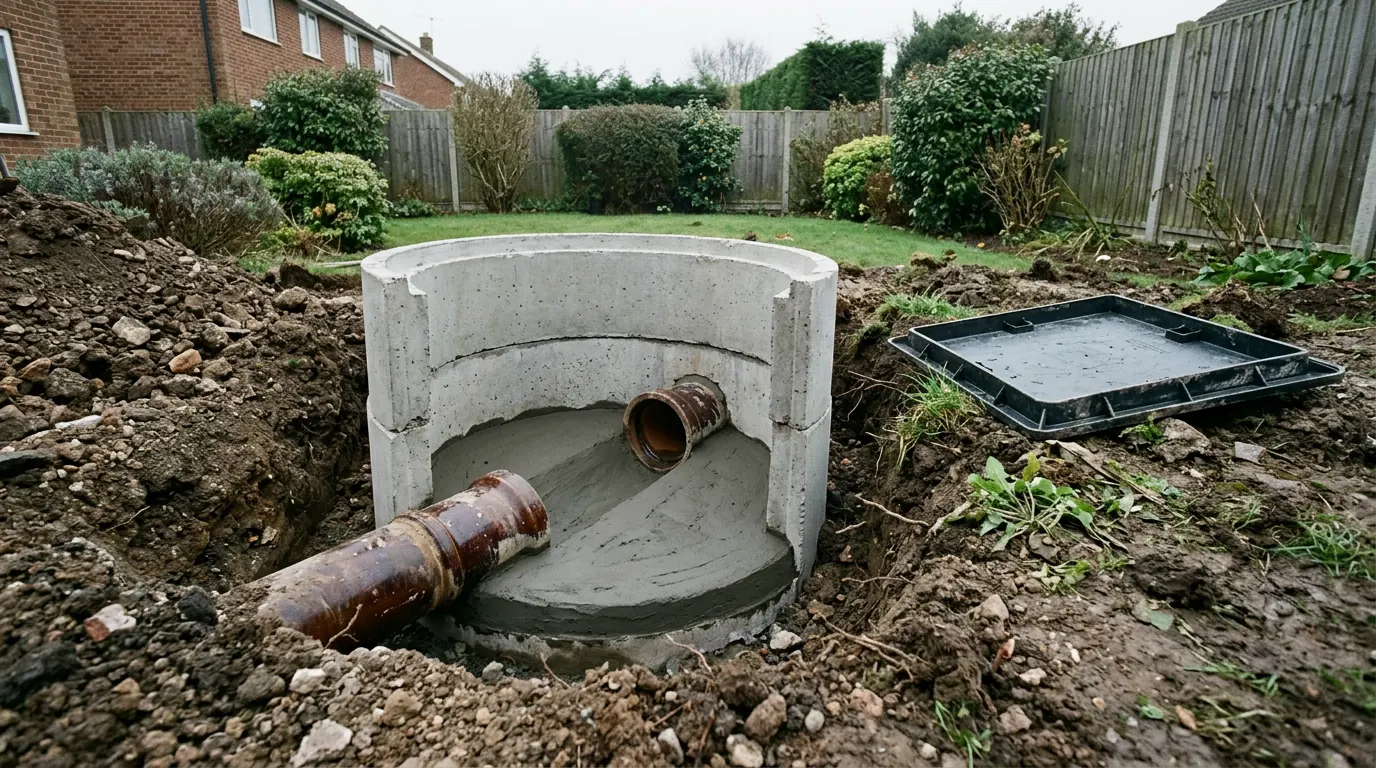
Climb away from the water and the ground changes completely to glacial till, the shrinkable boulder clay this district is founded on, as at Colne Engaine up on the plateau, where depth is driven by seasonal movement and by nearby trees. The parish rises to 73 metres at its south western boundary, so within one village you can be founding on wet alluvium or on dry clay fifty metres above it. Extension foundations explained covers how that choice gets made.
One bridge, one street, one railway
Access here is a genuine constraint rather than a scheduling inconvenience.
Everything arriving at a Bures site crosses the same bridge. The street through the centre is narrow, with listed frontages standing tight to the carriageway and very little verge to work from. Bures station sits on the Essex side, on the line up the Stour valley, which adds a level crossing to the sequence.
On a village-centre plot that means smaller loads, a grab lorry rather than a tipper for muck away, materials stored on the plot rather than delivered to a schedule, and deliveries kept out of the crossing and the school run. Where a house has no off-street space, a skip needs a permit from the relevant county council, which is the point at which knowing your side of the river stops being trivia. None of this is a reason not to build. It is a reason the programme should have been written by somebody who has stood on the street.
The housing, and what each type takes
A timber framed centre, a Victorian layer from the village’s industrial period, and twentieth century housing on both edges.
Nearest the bridge and along the street are the timber framed buildings, plastered or colourwashed, many of them listed. No cavity, no damp proof course, and frames that move. They need lime mortar and breathable build-ups, and they punish cement and sealed membranes. The extension that works on them is usually a shallow, wide addition at the back, clearly of its own date and set down from the old eaves rather than tied into them.
Then the Victorian brick, from the period when Bures was a working industrial village rather than a quiet one. Solid walls, deeper plans, higher ceilings, and the easiest of the older stock to extend at the rear.
Beyond both, on the edges of each parish, are the twentieth century houses and bungalows. Cavity brickwork, gardens with room in them, side access on a fair proportion, and on the later ones trussed rafter roofs that cannot simply have their middle removed for a loft conversion without a structural redesign. This is where most of the extension work in the village happens, and it is also where the designation boundary is most likely to have stopped short.
What people build here
Two quite different briefs, and the street you are on decides which of them is yours.

In the designated centre, the work is about winning one decent room at the back of a small old plan without arguing with the front elevation. A single storey rear extension remains permitted development within the reduced limits that apply on designated land, and where the plot has depth that is usually the whole job. Daylight is the design problem rather than the planning one, because a deep addition against an old rear wall makes a room the back windows cannot reach, which is why roof glazing stops being decorative on these houses and starts being structural to the brief.
On the twentieth century stock at the edges, the briefs are the familiar ones: opening the back of the house into a kitchen and living space, or converting the roof where the structure allows it. On the wider plots it is a garden building or an annexe, far enough from the house to be judged on its own terms.
Questions we get asked in Bures
How do I know which council I am under?
The river is the boundary. East of the Stour is Bures St Mary in Suffolk and Babergh District Council; west of it is Bures Hamlet in Essex and Braintree District Council. We confirm it from the address and the title, not from where the postbox is.
Are the rules stricter on one side than the other?
The permitted development rules are national and identical. The local policies, the validation requirements and the fees are not, and the officer applying design judgement is a different person working to a different plan.
My house is listed. Have I lost permitted development?
Not for extensions and roof work. Listing adds listed building consent as a separate requirement covering the interior as well, and that consent is usually the harder of the two to obtain. The two regimes run alongside each other.
Can I extend if I am near the river?
Generally yes. A flood risk assessment can be required in Zone 2 or 3, and the sequential test is not applied to a householder extension. The bigger practical issue is usually what the ground does in the trench.
Getting a price for a Bures extension
We are based at West Bergholt, and we work on both sides of this county boundary regularly enough to know which portal, which fee schedule and which local plan applies on which bank.
Our team surveys the property properly: which authority the address falls under, the designation position, the ground at the level you will be founding at, the trees, the drain runs, the frame if there is one, and how materials will physically reach the plot. Most people who call us already have drawings and permission and want a builder to price the work and build it. That is the ordinary job here, and we are glad to work to somebody else’s plans. Where the drawings do not exist yet, we bring in the technician who draws it and the structural engineer we work with to calculate it, we manage the application with the right council, we notify Building Control, and we run the job as main contractor.
We carry £2m public liability cover and everything is built to current Building Regulations, through to your completion certificate. The survey and the quotation cost nothing.
Last reviewed August 2026.
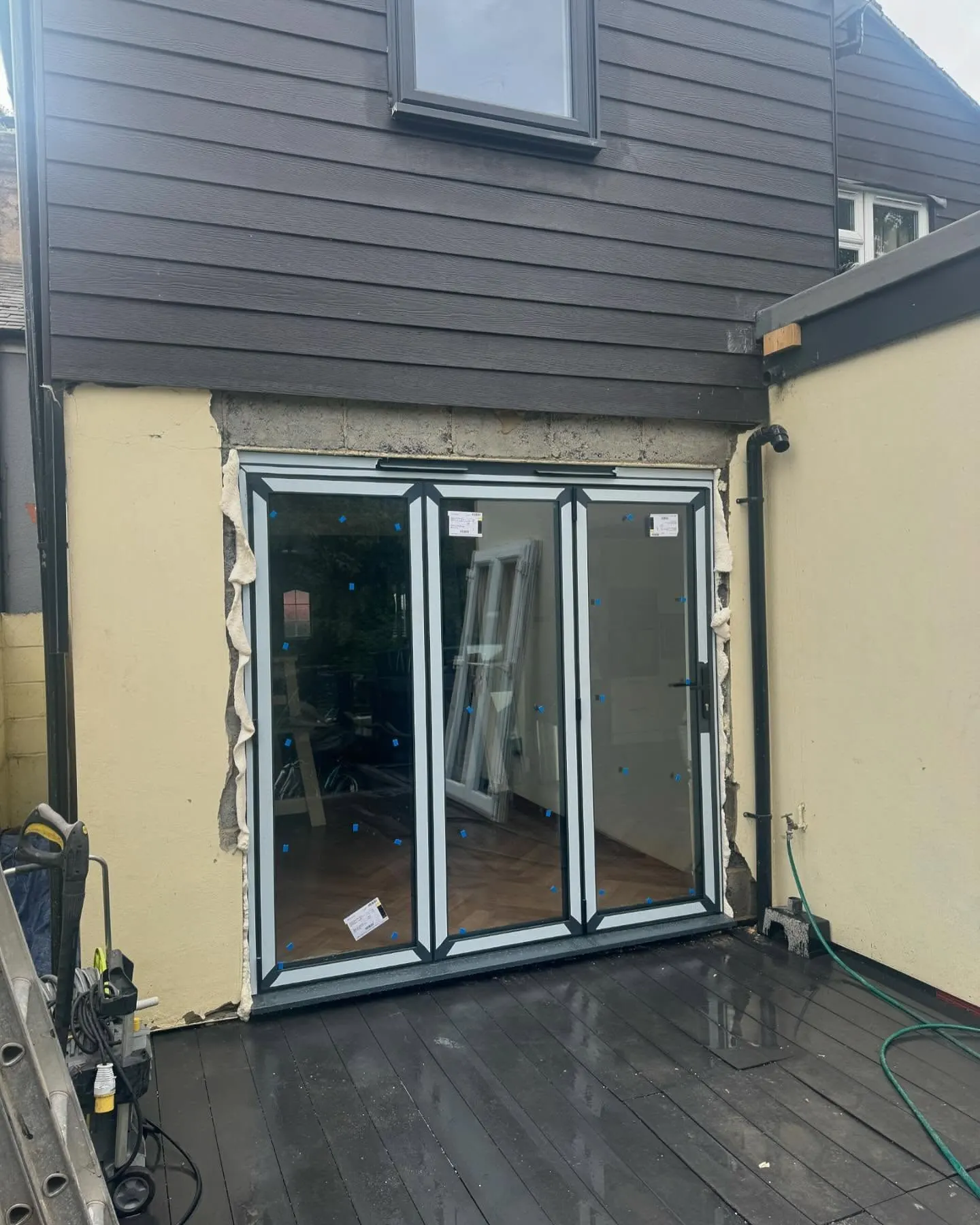
What the back of the house was, and is.
One of ours mid build and finished. No staging, and no borrowed images. Drag to reveal.
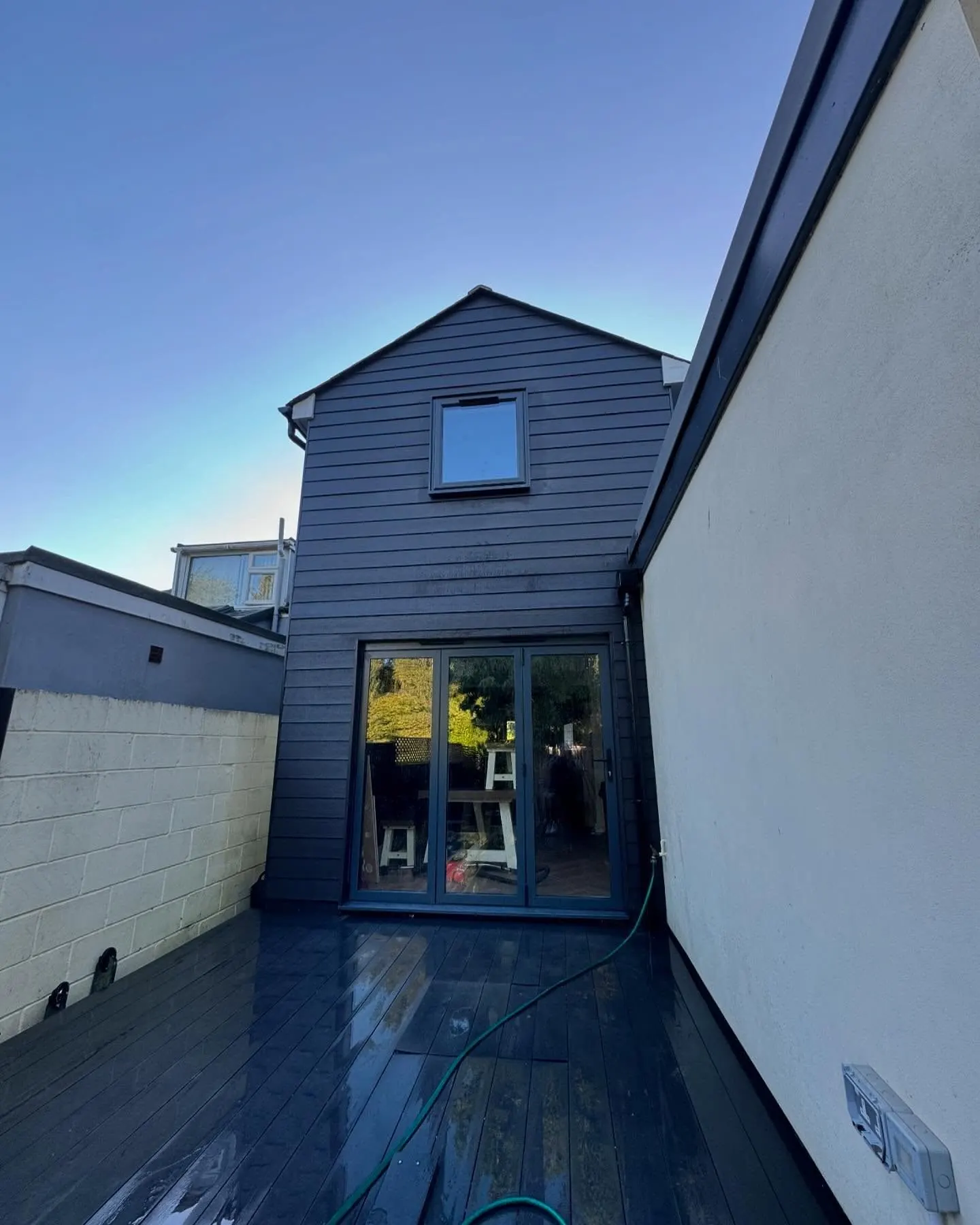
 During
Finished
During
Finished